ORLANDO, Fla. — The remnants of Cristina, a former Pacific tropical system, are moving across Central America and southern Mexico Thursday morning.
While the National Hurricane Center continues to monitor the area for possible redevelopment, the odds remain low.
The NHC currently gives the system just a 10% chance of tropical development over the next couple of days.

Forecasters say it is highly unlikely this disturbance will become the first named storm of the Atlantic hurricane season.
Even without significant development, the tropical moisture associated with Cristina’s remnants is expected to increase rain chances across portions of eastern Mexico and southern Texas in the coming days.
Meanwhile, hurricane researchers at Colorado State University have updated their seasonal outlook for the Atlantic Basin.
The revised forecast calls for a less active season than originally predicted.
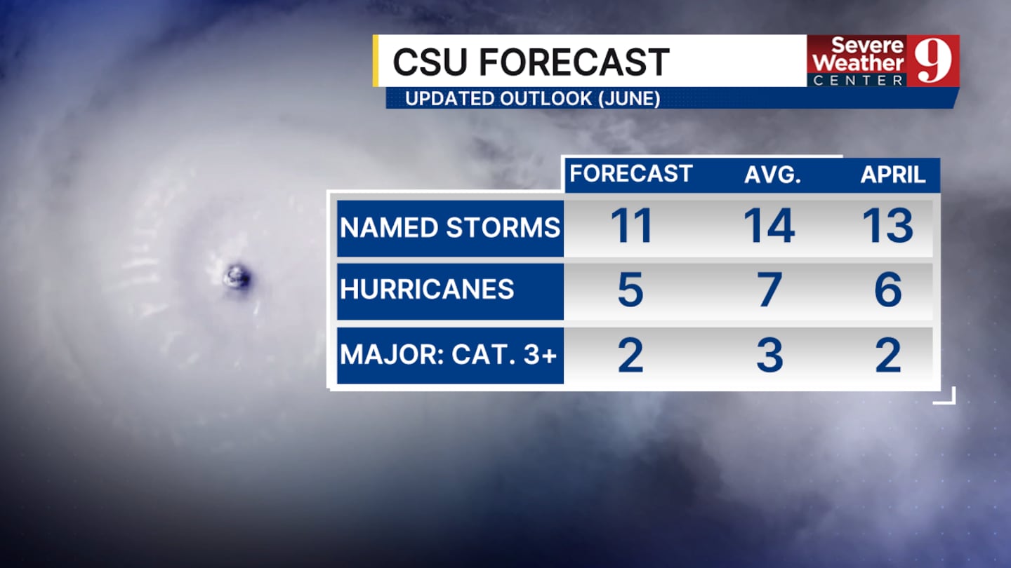
CSU now expects 11 named storms and five hurricanes during the 2026 Atlantic hurricane season, a reduction from its earlier outlook issued in April.
The adjustment is part of the university’s regular forecast update schedule, which includes revised outlooks in June, July, and August as atmospheric and oceanic conditions become clearer.
Despite the lower numbers, forecasters continue to stress that it only takes one storm impacting a populated area to make a hurricane season memorable, underscoring the importance of staying prepared throughout the season.
Click here to download our free news, weather and smart TV apps. And click here to stream Channel 9 Eyewitness News live.

©2026 Cox Media Group


