ORLANDO, Fla. — We continue to monitor two areas that could develop into the next named tropical storms in the Atlantic.
The area with a 20% chance to develop has been struggling for about a week and will likely dissipate in the coming days due to the dry air in the Middle Atlantic.

The next area has been dubbed invest 97L. It will still take at least two or three days to develop, but it does appear likely that this area will become more organized as it approaches the Leeward Islands.
The development is expected to occur in the middle to late part of this upcoming week. Once it reaches that strength, it will likely become the next named tropical storm shortly afterward.
The projected track remains uncertain. There are some positives when examining certain models with this system. Many of them indicate that the storm will turn northward before reaching the leeward Islands or approaching the Bahamas.
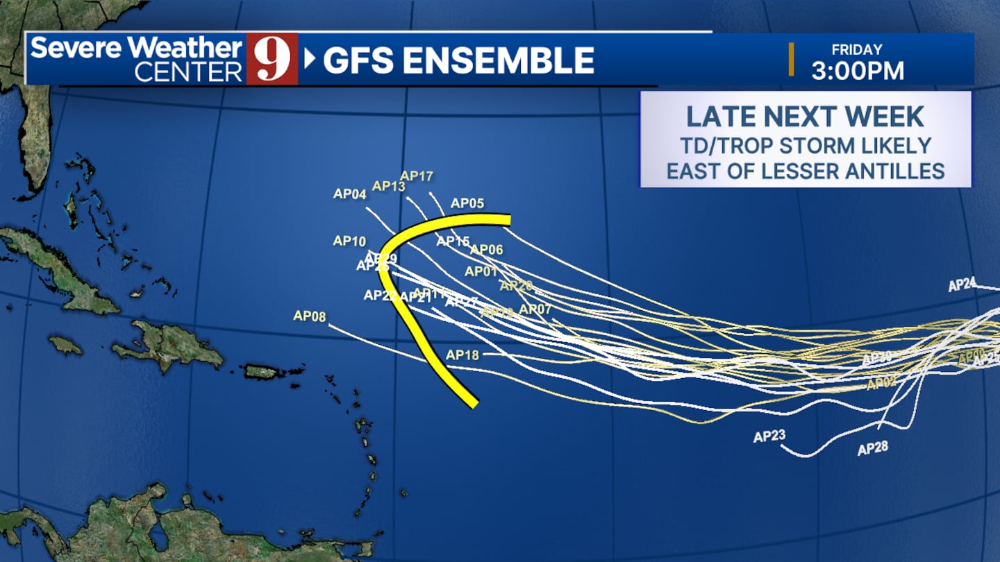
For us in Florida, this mainly would lead to increased ocean swell, with little else affected.
Click here to download our free news, weather and smart TV apps. And click here to stream Channel 9 Eyewitness News live.

©2025 Cox Media Group


