
5 PM UPDATE
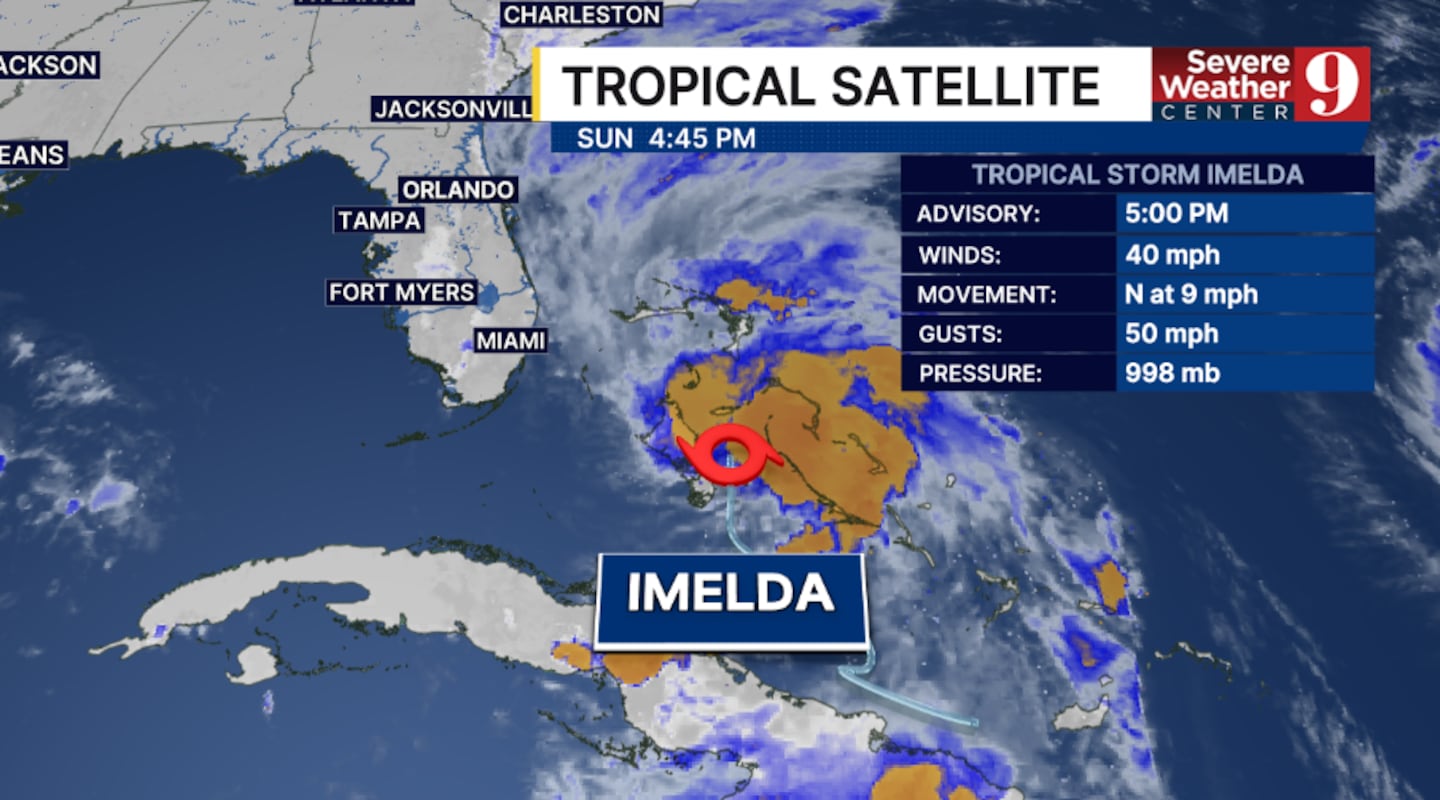
ORLANDO, Fla. — Tropical Storm Imelda is lifting northward across the Bahamas, and impacts along the coast are likely Sunday night through Tuesday.
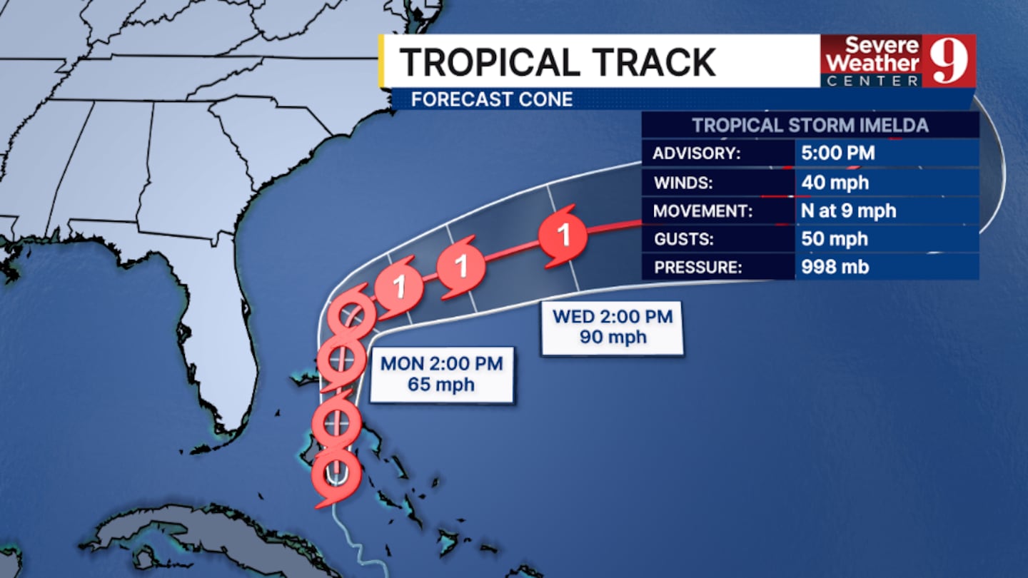
The 5 pm advisory from the National Hurricane Center had winds of 40 mph.
The Tropical Storm Watch for coastal Volusia and Brevard counties has been cancelled. The threat of tropical storm-force winds has decreased across the coast.
Imelda is expected to lift across the Bahamas Sunday into Monday and stay to the east of Florida.
Local Impacts
The system will mainly be an issue for coastal areas over the next several days.
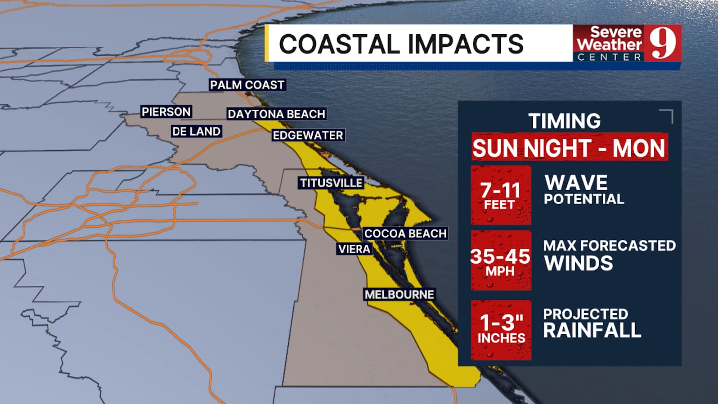
Right now, waves and marine impacts will likely arrive Sunday night.
Outer rain bands and gusty winds may begin to push into coastal Brevard County overnight Sunday into Monday.
The closest pass of the system to Central Florida will likely be Monday evening into Monday night.
Imelda is expected to turn eastward, away from the southeastern US, Tuesday into Wednesday.
Despite the turn, elevated beach and marine impacts will continue for much of the work week.
ORIGINAL STORY
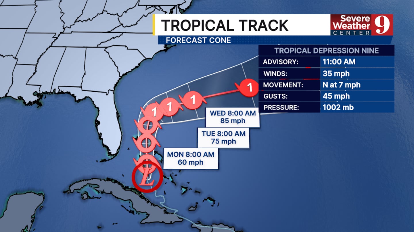
As of late Sunday morning, Tropical Depression 9 is still too disorganized to qualify as a tropical storm. It is currently just south of the Bahamas and will continue to track north over the next few days.
It will likely be upgraded to Tropical Storm Imelda by the end of the day today.
The projected track for T.S. Imelda continues to shift eastward. This is thanks to the front moving across Florida, which will help steer it out to sea.
The storm will make its closest pass to us in central Florida during the late afternoon on Monday. At closest, it will be about 150 to 200 miles offshore.
The first impacts we will see tonight will be the surf building and some rain arriving.
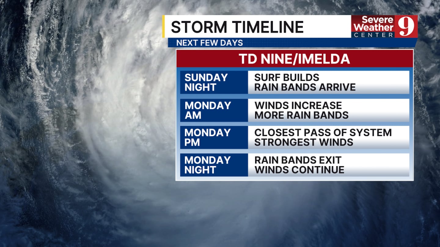
If you live along the coastline, you will also notice the winds increase overnight with gusts of 40 mph possible.
The strongest winds will be felt as the storm makes its closest pass during the latter half of Monday. There is a low chance of tropical storm-force winds, but if that occurs, it is most likely along the Brevard County coast.
Overnight Monday, the rain will stop, and the winds will gradually decrease as the storm continues to strengthen and move north.
Rain totals along our coast could reach up to 3 inches. Widespread flooding is unlikely in our area. The primary impact will be strong winds.
A few stray showers may extend inland to Orlando. The main effect on the city will be wind gusts of 20 to 25 mph caused by the storm being far offshore.
Click here to download our free news, weather and smart TV apps. And click here to stream Channel 9 Eyewitness News live.

©2025 Cox Media Group


