
ORANGE COUNTY, Fla. — We are starting to see pockets of rain pop up from that potential tropical wave we’ve been tracking for the last few days.
The chance of development has risen from 20% yesterday to 30% today. However, it is worth noting that the potential development area has shifted east.
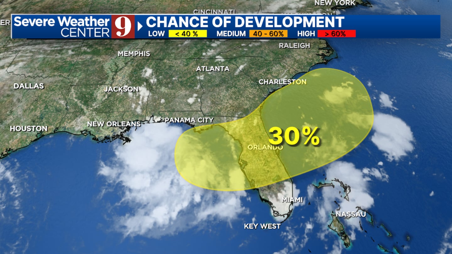
Anything that does happen is much more likely to occur in the Atlantic, rather than the Gulf or central Florida.
Whether this develops or not, heavy rain will be an issue for the next few days. We aren’t tracking severe thunderstorms, but rain totals between 2 and 5 inches are possible for central Florida.
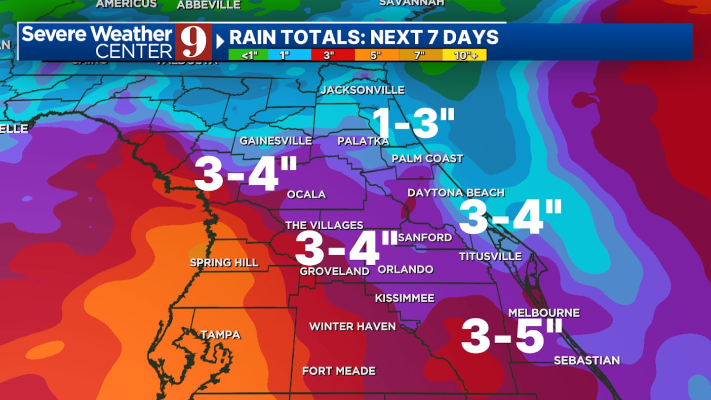
The timing will likely shift between now and Thursday but we are looking at all day Thursday and Friday morning to bring us the best chance to see widespread showers.
Central Florida will be done with any impacts by the end of the day Saturday at latest and we will return to the typical sea breeze afternoon storms that we are used to at that point in time.
Temperatures will also return to the low 90s.
Click here to download our free news, weather and smart TV apps. And click here to stream Channel 9 Eyewitness News live.

©2025 Cox Media Group


