ORLANDO, Fla. — Sunday signals a major shift in the Orlando weather pattern, ushering in drier conditions across Central Florida. The persistent low pressure system delivering recent rain and gusty winds is finally moving north, allowing high pressure to build in from the west and dominate the Central Florida forecast.
This incoming high pressure ridge will steer us into a classic Florida fall week, with rain chances dropping to minimal levels. Expect moderate afternoon temperatures in the low to mid 80s and refreshingly cool mornings, perfect for enjoying Orlando’s seasonal vibe.
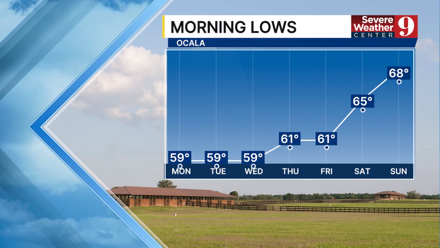
Central Florida mornings could dip into the 60s for the next 7 to 10 days, a welcome chill fueled by dry air that also allows daytime highs to climb efficiently under sunny skies.
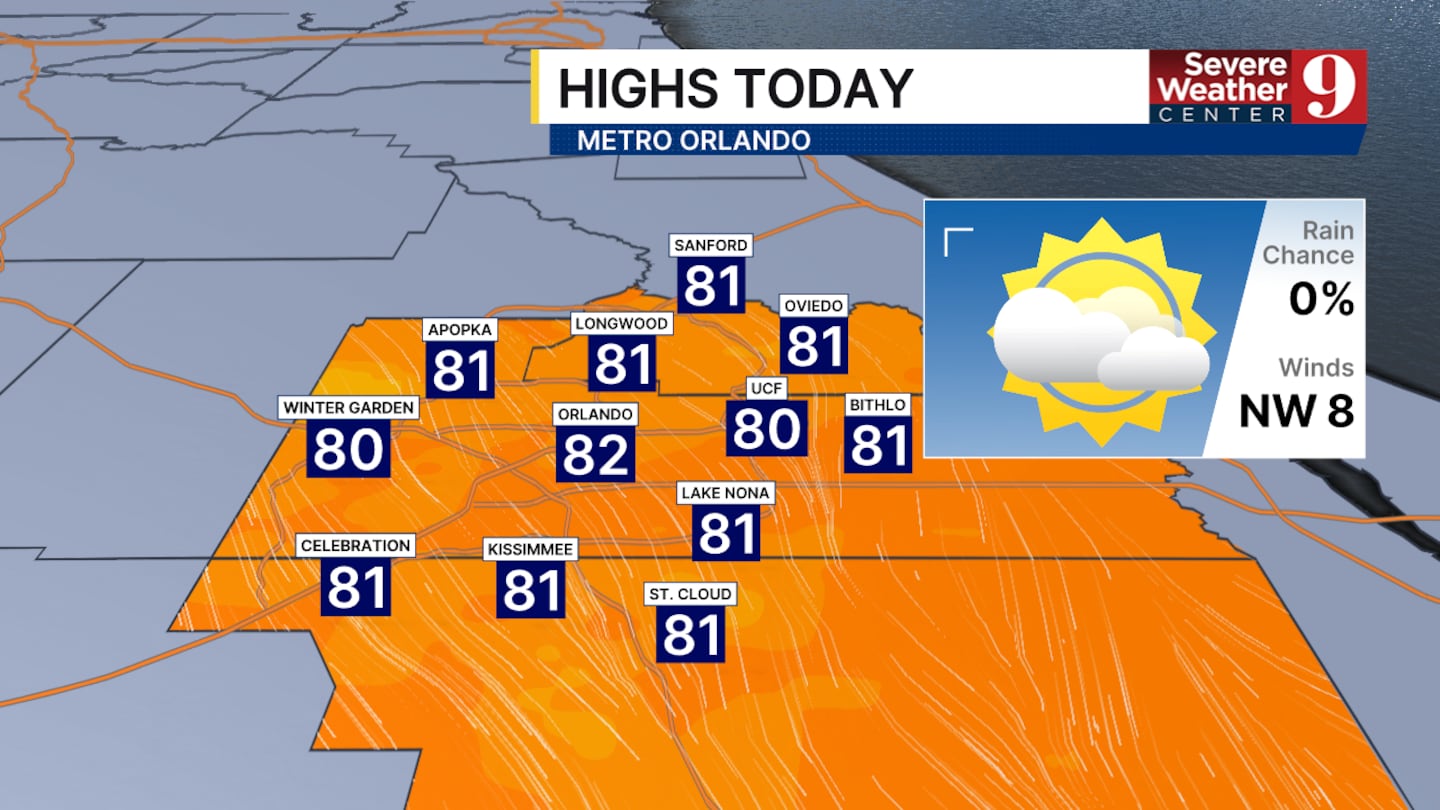
Fortunately, Orlando weather projections keep afternoon highs in check—no scorching heat waves ahead. Look for low 80s today, transitioning to steady mid 80s through much of the upcoming week.
Rain chances in Central Florida will remain subdued, with no major downpours on the horizon, though a few scattered days might bring brief passing showers from isolated pop-up storms.
Overall rain totals for Orlando and the surrounding areas should stay well under half an inch, keeping the focus on comfortable fall weather rather than flood watches.
Click here to download our free news, weather and smart TV apps. And click here to stream Channel 9 Eyewitness News live.

©2025 Cox Media Group