
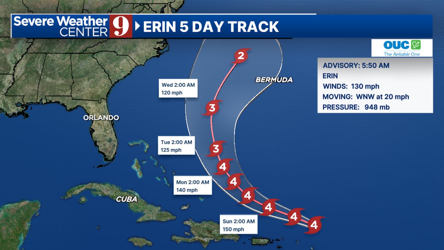
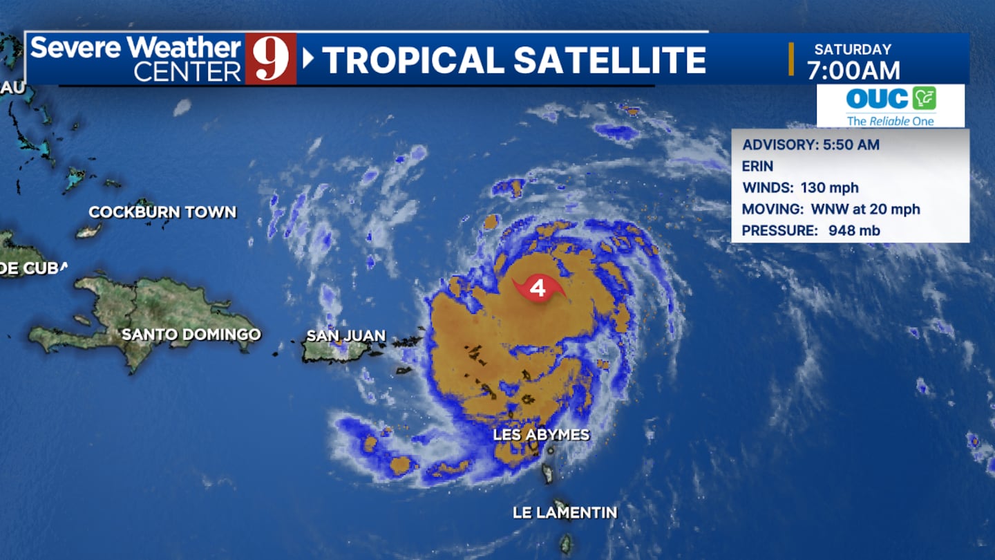
ORLANDO, Fla. — Hurricane Erin has become the first major hurricane of the 2025 season, reaching category four status with winds of 130 mph.
The storm is currently positioned in the Atlantic Ocean and is expected to move north after passing the Leeward Islands, potentially approaching Bermuda.
A strong high-pressure system is helping to keep Erin away from the southeastern United States, reducing the likelihood of a direct impact.
Central Florida is expected to experience rip currents and high surf due to Hurricane Erin.
The biggest waves are anticipated on Wednesday, with periods of 15 to 17 seconds along the coast.
New Smyrna Beach will likely see the largest waves, but similar conditions are expected at Daytona Beach and Cocoa Beach, particularly on Wednesday.
A high rip current risk is expected from Monday to Friday, prompting caution for beachgoers throughout the week.
Conditions are expected to calm by the end of next week as the storm moves further away, minimizing its impact on the region.
▶ WATCH CHANNEL 9 EYEWITNESS NEWS

Read:
Read:
Read:
Click here to download our free news, weather and smart TV apps. And click here to stream Channel 9 Eyewitness News live.
©2025 Cox Media Group


