
ORLANDO, Fla. — The heat is returning to typical levels for this time of year, with highs in the low 90s. We are also monitoring better rain chances for Sunday compared to the last few days.
High temperatures will hold steady in the low 90s for the next week.
Today we could see a bit of a heat index with it feeling like the upper 90s outside, but with drier conditions headed our way this will not be the case for most of the next work week.
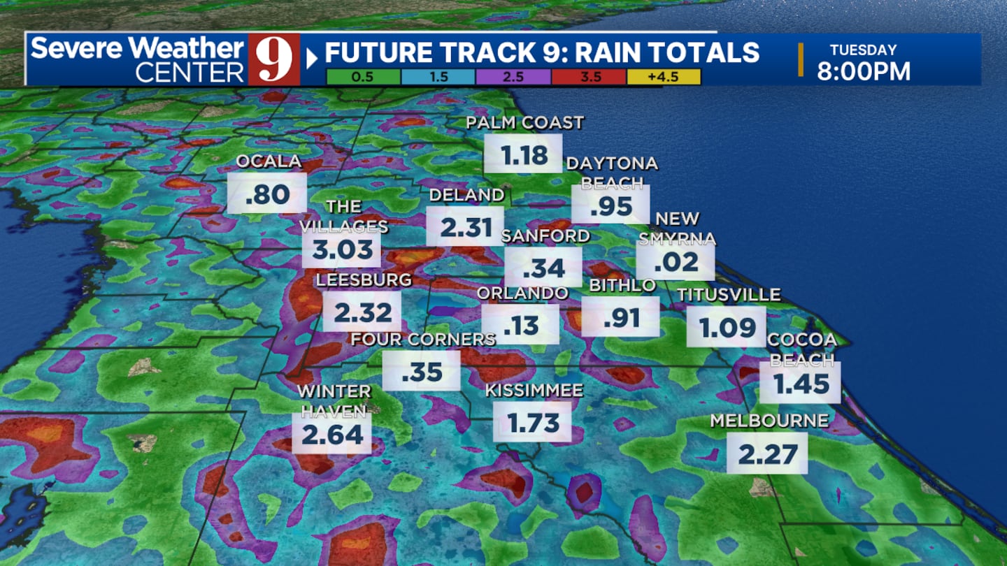
We are not expecting widespread severe weather, but a couple stronger thunderstorms are possible in central Florida. Our main threats will be lightning, wind gusts of 30 mph and pockets of heavy rain.
High pressure will build up by Tuesday and Wednesday bringing down our rain chances and most importantly keeping hurricane Erin far away from our state.
Click here to download our free news, weather and smart TV apps. And click here to stream Channel 9 Eyewitness News live.

©2025 Cox Media Group


