
ORLANDO, Fla. — It was an unsettled end to the weekend, and more rain and storms are on the way for Monday.
The rain and storms will slowly fade away again this evening, with mostly cloudy skies overnight. Morning lows will be in the mid 70s.
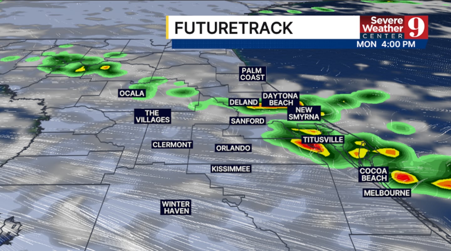
More active weather is ahead for Monday. After a fairly quiet morning, scattered rain and storms will develop in the PM hours. The greatest threat for activity will be along and east of I-4, with temperatures in the upper 80s.
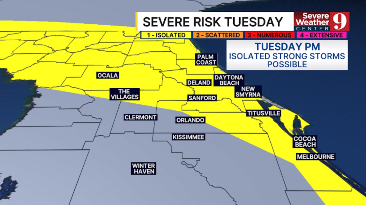
We have Weather On the Way for Tuesday as a cold front nears the area. Fairly widespread storms are expected late in the day, and some storms could be strong. Highs for Tuesday will be in the upper 80s.
Some much drier air will begin to push into the area for midweek, reducing rain chances. Expect scattered activity both Wednesday and Thursday, with highs in the mid-80s.
Rain chances look minimal to close out the work week, and the drier air will likely persist into next weekend.
Click here to download our free news, weather and smart TV apps. And click here to stream Channel 9 Eyewitness News live.

©2026 Cox Media Group


