ORLANDO, Fla. — We are tracking the coldest air of the season so far that will move into our area in the early part of next week.
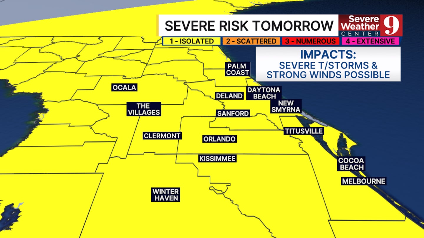
A strong cold front will bring widespread showers and potential thunderstorms on Sunday. A few strong to severe storms are possible during the afternoon. Widespread severe weather is not expected.
The bigger impact from this front will be the cold air that arrives early Monday.
Temps will be held in the low to mid 60s during the afternoon on Monday while we dry out.
The impact of the north wind, the dry air and the front itself will cause much of central Florida to fall into the mid 40s.
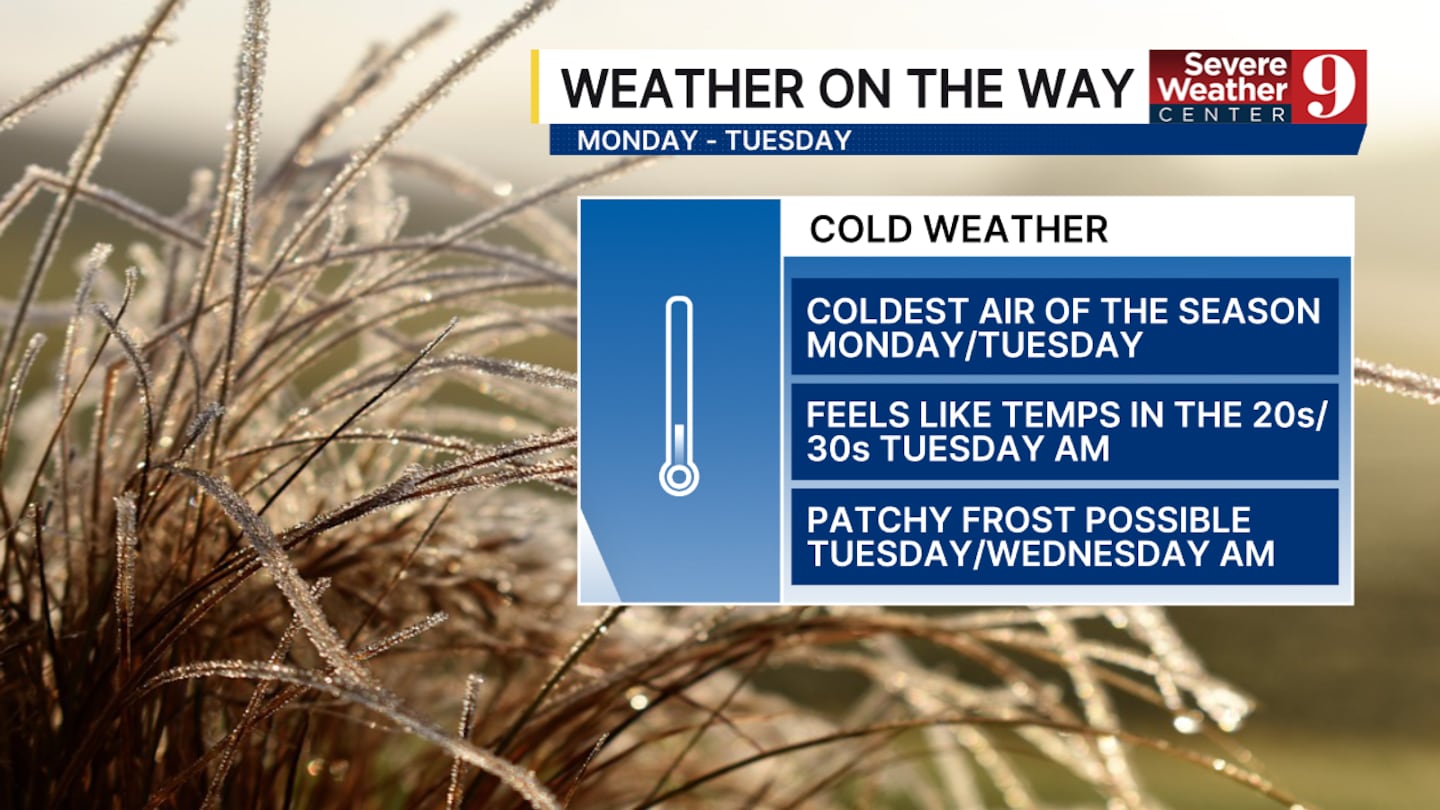
There will be a handful areas such as Marion, Lake and portions of Volusia county that could fall into the upper 30s.
Frost will be possible in some of our inland counties such as Sumter and Marion.
The dry air will help us warm up relatively quickly. Overnight lows will be back into the 50s by Thursday morning.
Click here to download our free news, weather and smart TV apps. And click here to stream Channel 9 Eyewitness News live.

©2025 Cox Media Group


