ORLANDO, Fla. — Central Florida will be hot and drier Friday and into the weekend.
>>> STREAM CHANNEL 9 EYEWITNESS NEWS LIVE <<<
There will be a 20% chance of afternoon rain and storms in our area.
Conditions should remain drier for the next few days.
Read: 9 things to do for the first fall weekend of the year
Before any potential storms fire up, the average high temperature should reach around 89 degrees.
Tropical Depression 9 formed Friday morning and could impact Florida by next week.
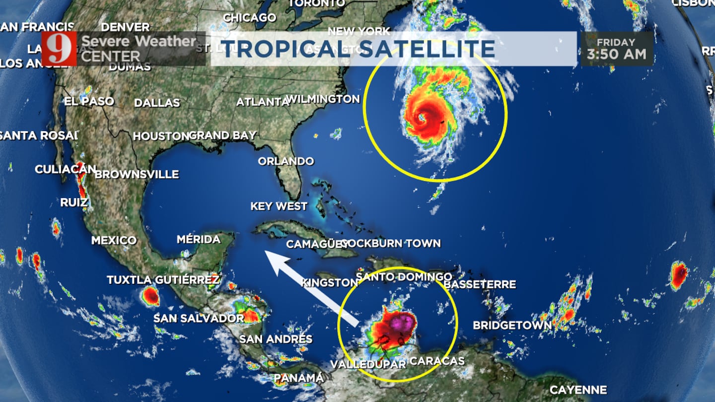
TD9 is currently in the central Caribbean moving west-northwest at 10 to 15 mph.
The tropical disturbance is forecast to develop into a hurricane by this weekend.
Read: 9 ways to celebrate fall in Central Florida
The storm could be near western Cuba by early next week.
The forecast models for TD9 currently have the system moving toward the west coast of Florida or South Florida.
Florida residents are encouraged to have their hurricane plans in place, but full-throttle preparations are not needed at this point.
Watch: Hurricane Fiona to bring rough surf, strong rip currents to Volusia County beaches
>>> WATCH LIVE RADAR HERE <<<
Follow our Severe Weather team on Twitter for live updates:
Visit our hurricane section: EYE ON THE TROPICS
Click here to download the free WFTV news and weather apps, click here to download the WFTV Now app for your smart TV and click here to stream Channel 9 Eyewitness News live.

©2022 Cox Media Group


