ORLANDO, Fla. — Tropical Storm Milton will gradually gain strength Sunday and will most likely become a hurricane by Sunday evening.
▶ WATCH CHANNEL 9 EYEWITNESS NEWS
▶ DOWNLOAD OUR APPS
11:00 update:
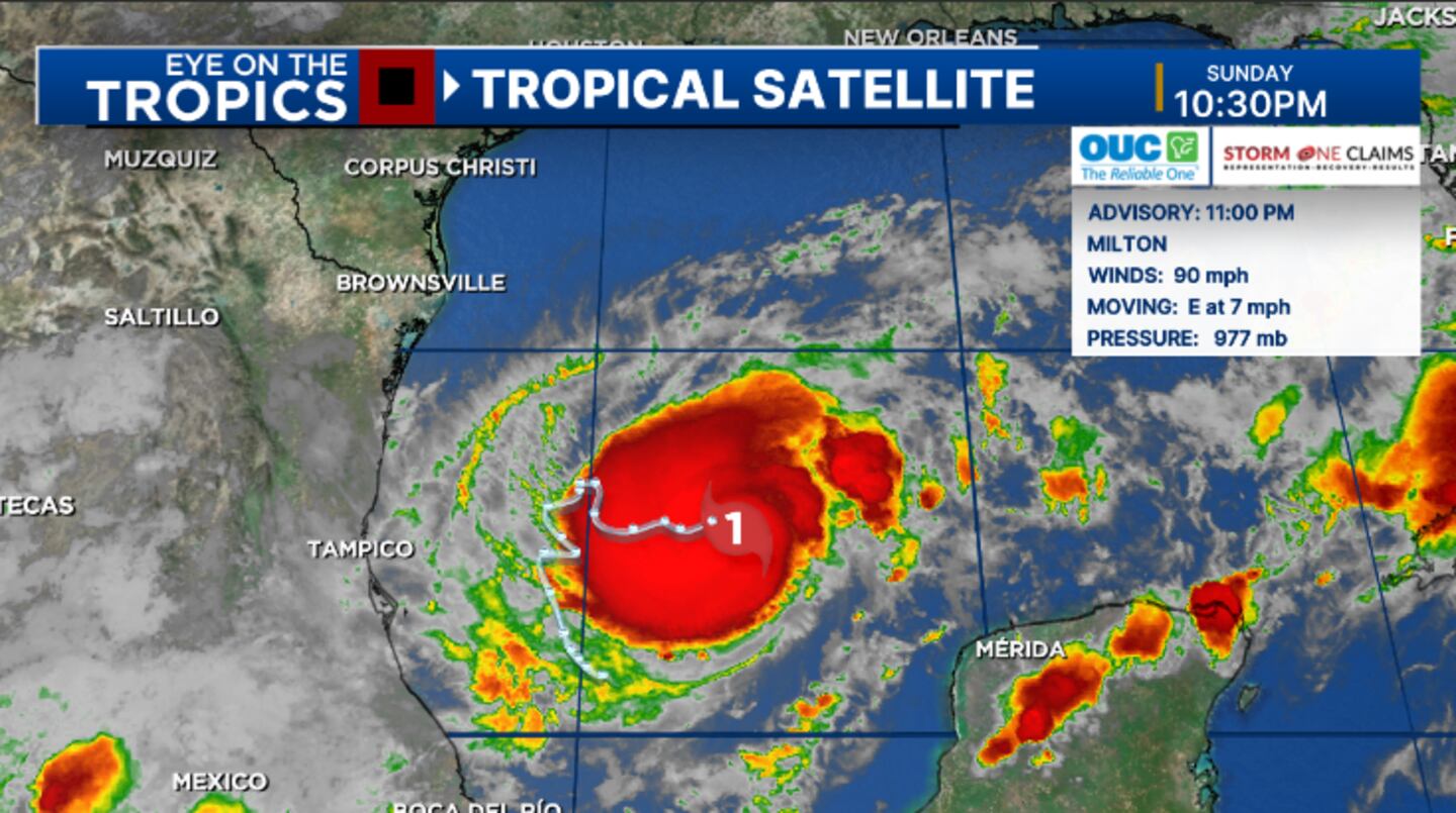
Milton continues to intensify in the Gulf of Mexico and remains on track to impact much of Florida midweek.
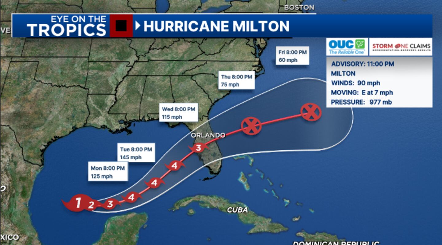
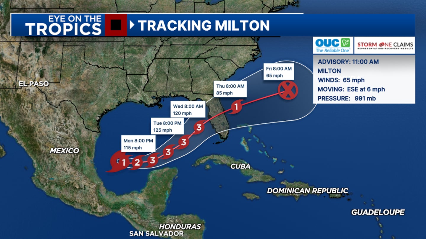
The 11 pm advisory from the National Hurricane Center has winds of 90 mph, making Milton a Category 1 storm.
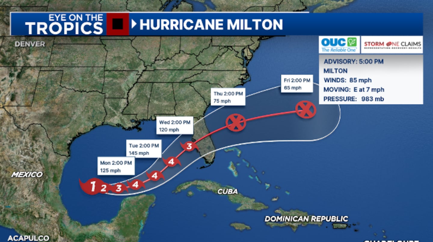
Milton is still expected to strengthen further and become a Category 3 major hurricane by Monday, and a Category 4 storm Tuesday.
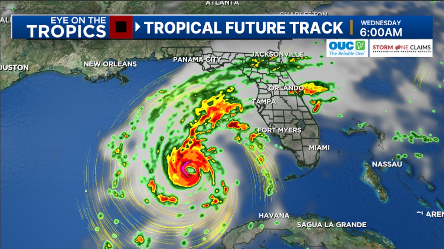
The updated track now shows Milton making landfall along the west coast of Florida Wednesday night, potentially as a major hurricane. It is then expected to track across Central Florida overnight Wednesday into early Thursday.
It is becoming increasingly likely Milton will create very significant impacts for parts of the west coast of Florida, including significant storm surge and hurricane force winds.
Hurricane Watches and Storm Surge Watches will likely be issued early Monday for parts of the west coast.
In Central Florida, impacts will be based on the exact track of the storm, but impacts continue to increase. Watches will likely be issued for much of Central Florida Monday and Monday evening.
Stay with Channel 9 for updates on Milton.
8:00 update:
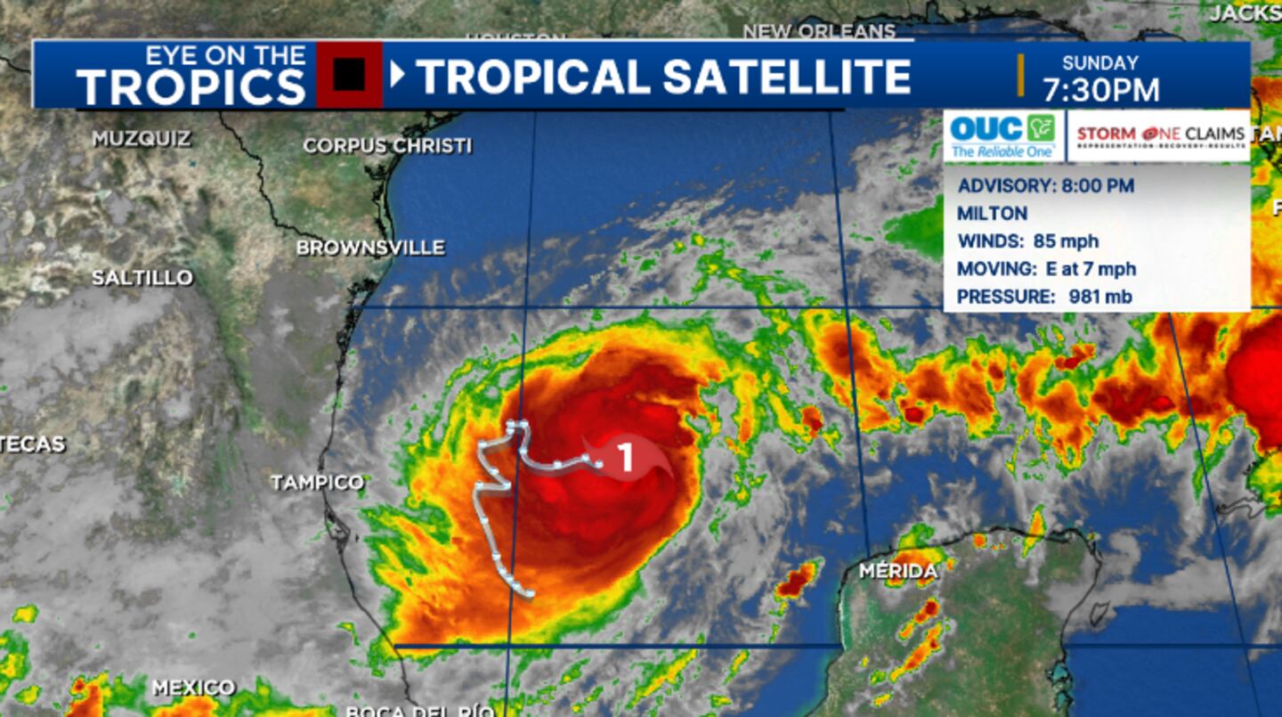
Milton continues to organize in the Gulf and is expected to be a major hurricane in the next 48 hours.
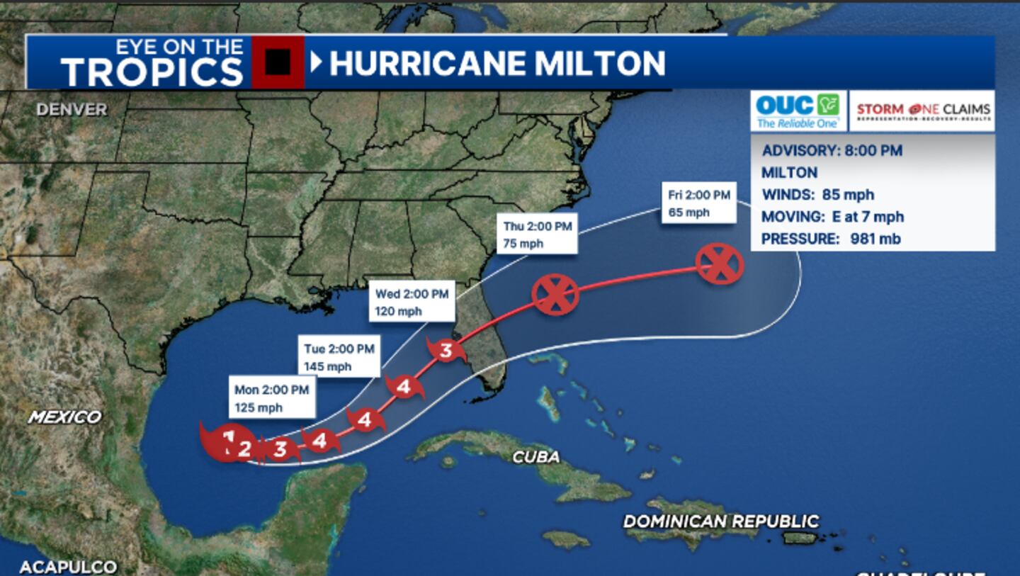
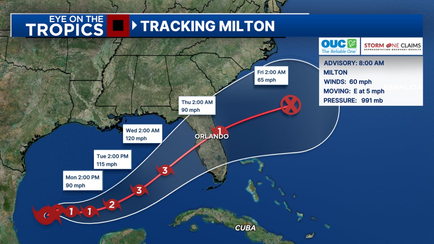
The 8 pm advisory from the National Hurricane Center has winds of 85 mph, making Milton a Category 1 storm.
Milton is expected to strengthen further and become a Category 3 major hurricane by Monday, and a Category 4 storm Tuesday.
The latest track continues to show Milton making landfall along the west coast of Florida on Wednesday, potentially as a major hurricane. It is then expected to track across Central Florida Wednesday night into early Thursday.
The storm will likely bring significant impacts to parts of the west coast of Florida, including significant storm surge and hurricane-force winds.
Hurricane Watches and Storm Surge Watches will likely be issued tonight or early Monday for parts of the state.
In Central Florida, the impacts will be based on the exact track of the storm, but the threat for impacts are increasing for Wednesday and early Thursday.
Stay with Channel 9 for updates on Milton.
5:00 p.m. update:
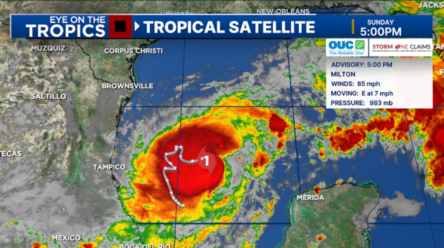
Milton continues to intensify in the Gulf of Mexico and is now expected to be a Category 4 storm before moving toward Florida.
The 5 pm advisory from the National Hurricane Center has winds of 85 mph, making Milton an intensifying Category 1 storm.
Milton is expected to strengthen further and become a Category 3 major hurricane by Monday, and a Category 4 storm Tuesday.
The latest track continues to show Milton making landfall along the west coast of Florida on Wednesday, potentially as a major hurricane. It is then expected to track across Central Florida Wednesday night into early Thursday.
The storm will likely bring significant impacts to parts of the west coast of Florida, including significant storm surge and hurricane-force winds.
Hurricane Watches and Storm Surge Watches will likely be issued later tonight or early Monday for parts of the state.
In Central Florida, the impacts will be based on the exact track of the storm, but the threat for impacts are increasing for Wednesday and early Thursday.
Stay with Channel 9 for updates on Milton.
3:45 update:
Marion County announces emergency information for the county.
Marion County Public School Closures:
Marion County Public Schools announced that schools will be CLOSED on Wednesday, October 9, 2024, and Thursday, October 10, 2024.
All extra-curricular, after-school activities are canceled on Tuesday, except Marion Afterschool Programs, which will operate as usual.
Shelter Information:
The following locations will open as emergency shelters in preparation for Hurricane Milton. Citizens with special dietary needs should bring a supply of food with them.
• Special Needs Shelter: Westport High School, 3733 SW 80th Avenue, Ocala, will open at 5:00 p.m. on Tuesday, October 8, 2024. Small pets are also allowed into the shelter with proper documentation.
• Pet-Friendly Shelter: Vanguard High School, 7 NW 28th Street, Ocala, FL 34475.
• General Population Shelter: Fort McCoy School, 16160 NE County Road 315, Fort McCoy, FL 32134
Citizen information Line:
The Marion County Emergency Management Citizen’s Information Line will open Monday, October 7, 2024, from 8:00 a.m. to 8:00 p.m. For non-emergency inquiries related to the weather event, please call 352-369-7500. For emergencies, always dial 911.
3:30 P.M. update:
Volusia County announces after-school activities except for Extended Day Enrichment Programs will be canceled on Monday, Oct. 7.
2:25 p.m. update:
Milton has become a hurricane in the Gulf of Mexico and is on track to impact Florida later this week as a potential major hurricane.
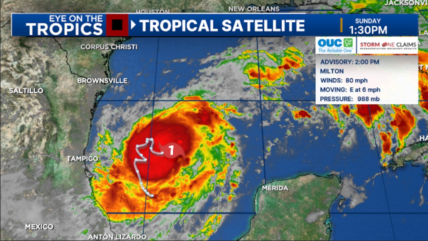
Hurricane Hunters at 2 pm found winds of 80 mph, making Milton a Category 1 hurricane.
Milton is expected to strengthen further and possibly become a Category 3 major hurricane by Monday.
The latest track shows Milton making landfall along the west coast of Florida on Wednesday, potentially as a major hurricane. It is then expected to track across Central Florida Wednesday night into early Thursday.
The storm will likely significant impacts to parts of the west coast of Florida, including significant storm surge and hurricane-force winds.
In Central Florida, the impacts will be based on the exact track of the storm, but some impacts are becoming likely Wednesday into early Thursday.
Stay with Channel 9 for constant updates on Milton.\
1:57 p.m. update:
Air Force Hurricane Hunters have found Milton has become a hurricane.
The hunters have found winds of 80 mph, making Milton a Category 1 hurricane in the Gulf of Mexico.
Hurricane #Milton Advisory 5A: https://t.co/tW4KeGe9uJ
— National Hurricane Center (@NHC_Atlantic) October 6, 2024
1:34 p.m. update:
Governor Ron DeSantis will hold a press conference in Tallahassee at the State Emergency Operations Center on Sunday at 5 p.m.
Florida Division of Emergency Management Director Kevin Guthrie will join him.
WTV Channel 9 will carry the press conference on-air and on wftv.com.
Tropical Storm Milton is now slowly organizing in the Gulf and is on track to become a major hurricane as it nears Florida.
11:34 a.m. update:
Governor Ron DeSantis issued Executive Order (EO) 24-214, declaring a state of emergency ahead of Tropical Storm Milton’s landfall.
DeSantis has declared a state of emergency in 51 Florida counties ahead of the storm, including Alachua, Baker, Bradford, Brevard, Broward, Charlotte, Citrus, Clay, Collier, Columbia, DeSoto, Dixie, Duval, Flagler, Gilchrist, Glades, Hamilton, Hardee, Hendry, Hernando, Highlands, Hillsborough, Indian River, Lafayette, Lake, Lee, Levy, Madison, Manatee, Marion, Martin, Miami-Dade, Monroe, Nassau, Okeechobee, Orange, Osceola, Palm Beach, Pasco, Pinellas, Polk, Putnam, Sarasota, Seminole, St. Johns, St. Lucie, Sumter, Suwanee, Taylor, Union, and Volusia counties.
11 a.m. update:
Tropical Storm Milton continues to gradually strengthen.
The storm is expected to become a hurricane by this evening.
Milton remains on track for a midweek landfall on Florida’s west coast.
Tropical Storm Warnings have been issued for the northern coast of the Yucatan.
No other advisories issued yet.
10:39 a.m. update:
The National Weather Service said a flood advisory has been extended to 12 p.m. for portions of Brevard County.
Between 2 and 3.5 inches of rain have fallen and an additional 1 to 2 inches are expected.
10:25 AM | Flood Advisory has been extended in time through noon today for portions of Brevard County. Between 2 and 3.5 inches of rain have fallen. Additional rainfall amounts of 1 to 2 inches are expected over the area. #FLwx pic.twitter.com/YsUpSkLKOJ
— NWS Melbourne (@NWSMelbourne) October 6, 2024
8:18 a.m. update:
Tropical Storm Milton continues to strengthen in the Gulf Of Mexico.
Winds of 60 miles per hour.
Gradual strengthening will continue today and Milton will most likely reach hurricane status this evening.
A tropical storm watch is in place for parts of Mexico.
No additional advisories have been issued yet.
7:00 a.m. update:
Tropical Storm Milton is forecasted to rapidly intensify as it moves over very warm waters of the Gulf of Mexico.
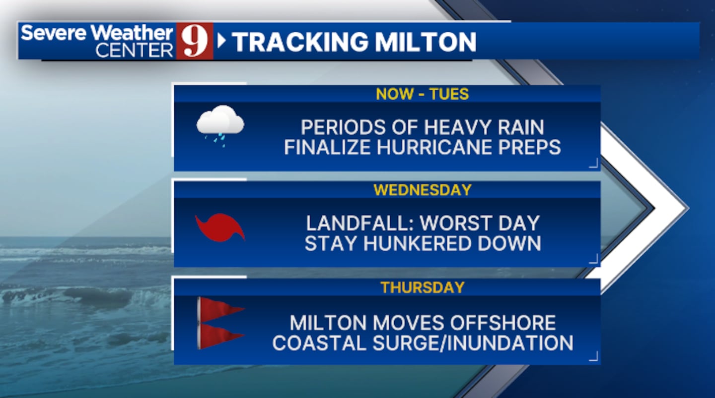
It will approach Florida’s west coast as a major hurricane, possibly a Category 3, by Wednesday afternoon.
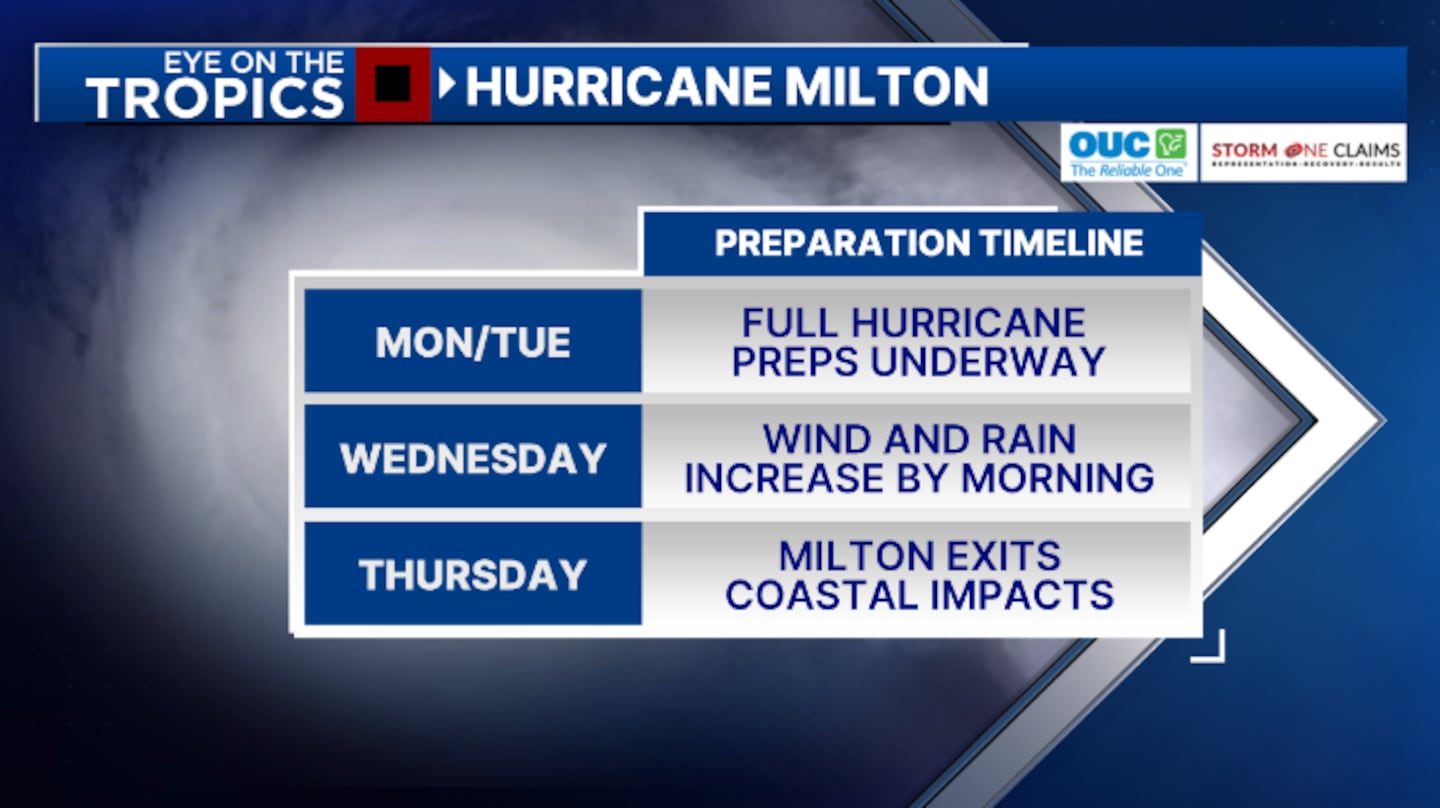
Central Florida residents should start making hurricane preparations on Sunday.
Tropical storm conditions will likely be present for much of Central Florida by Wednesday at the earliest.
Heavy rain, strong winds, isolated tornadoes and power outages will all be possible by the middle of the week and move off our east coast by Thursday morning.
6:00 a.m. update:
Governor Ron DeSantis will hold a press conference in Tallahassee at the State Emergency Operations Center on Sunday at 9:30 a.m.
Florida Division of Emergency Management Director Kevin Guthrie will join him.
WTV Channel 9 will carry the press conference on-air and on wftv.com.
On Saturday, Gov. DeSantis declared a state of emergency for 35 Florida counties ahead of the Tropical Storm Milton, including all of Central Florida.
Tropical Storm Milton is now slowly organizing in the Gulf and is on track to become a major hurricane as it nears Florida.
The 11 pm advisory from the National Hurricane Center showed winds of 45 mph, indicating Milton is strengthening.
The storm is expected to become a hurricane Sunday night and could be a Category 3 major hurricane Tuesday night in the eastern Gulf.
Click here to download our free news, weather and smart TV apps. And click here to stream Channel 9 Eyewitness News live.
©2024 Cox Media Group

