ORLANDO, Fla. — The tropics remain active this Friday evening, with Erin in the North Atlantic and two other areas of interest.
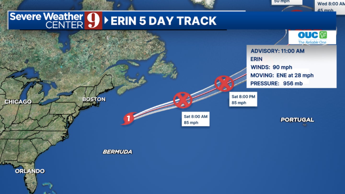
Erin, once a powerful Cat 5 storm, continues to weaken as it pulls away from the US. The hurricane is expected to become post-tropical this weekend and push further north in the North Atlantic.
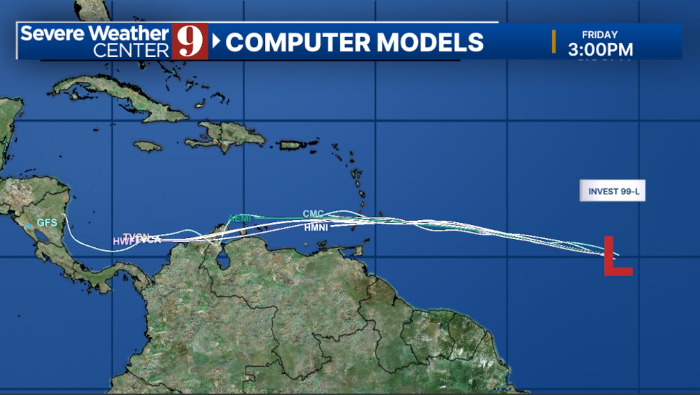
Elsewhere, our next system will probably develop this weekend. An area north of Puerto Rico is showing signs of potentially becoming a tropical depression or tropical storm.
This area has a Very High Development Chance and will likely become a depression or storm Saturday or Sunday.
It will move northward and remain well east of Florida. Another area is in the open waters of the Atlantic. This could organize over the next 24 hours, but conditions are unfavorable for development this weekend.
The system could potentially organize next week as it approaches the Lesser Antilles. This has a Medium Development Chance.
Right now, Florida isn’t facing any threats as August comes to an end. Stay tuned to Severe Weather Center 9 for the latest updates on the tropics throughout the season.
Click here to download our free news, weather and smart TV apps. And click here to stream Channel 9 Eyewitness News live.

©2025 Cox Media Group