
ORLANDO, Fla. — We have Weather On the Way for the early part of next week, as the coldest air of the season plunges into Central Florida.
A strong cold front will usher in the chilly air Sunday night into early Monday morning. Monday’s highs will only reach the low 60s, accompanied by strong northerly winds.
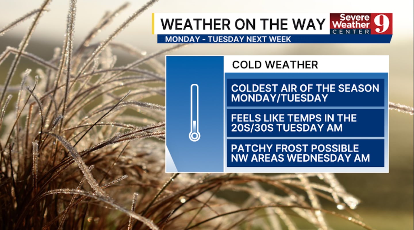
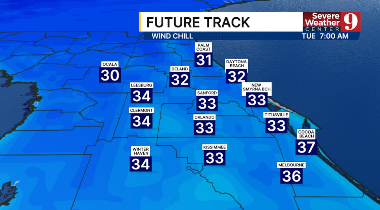
Temps will really tumble Monday night, when morning lows will be the coldest since late February. Morning lows will be in the 30s and 40s, with feels-like temps in the 20s and 30s by daybreak Tuesday.
Tuesday will be the coldest day of the stretch, with highs struggling to climb into the low 60s.
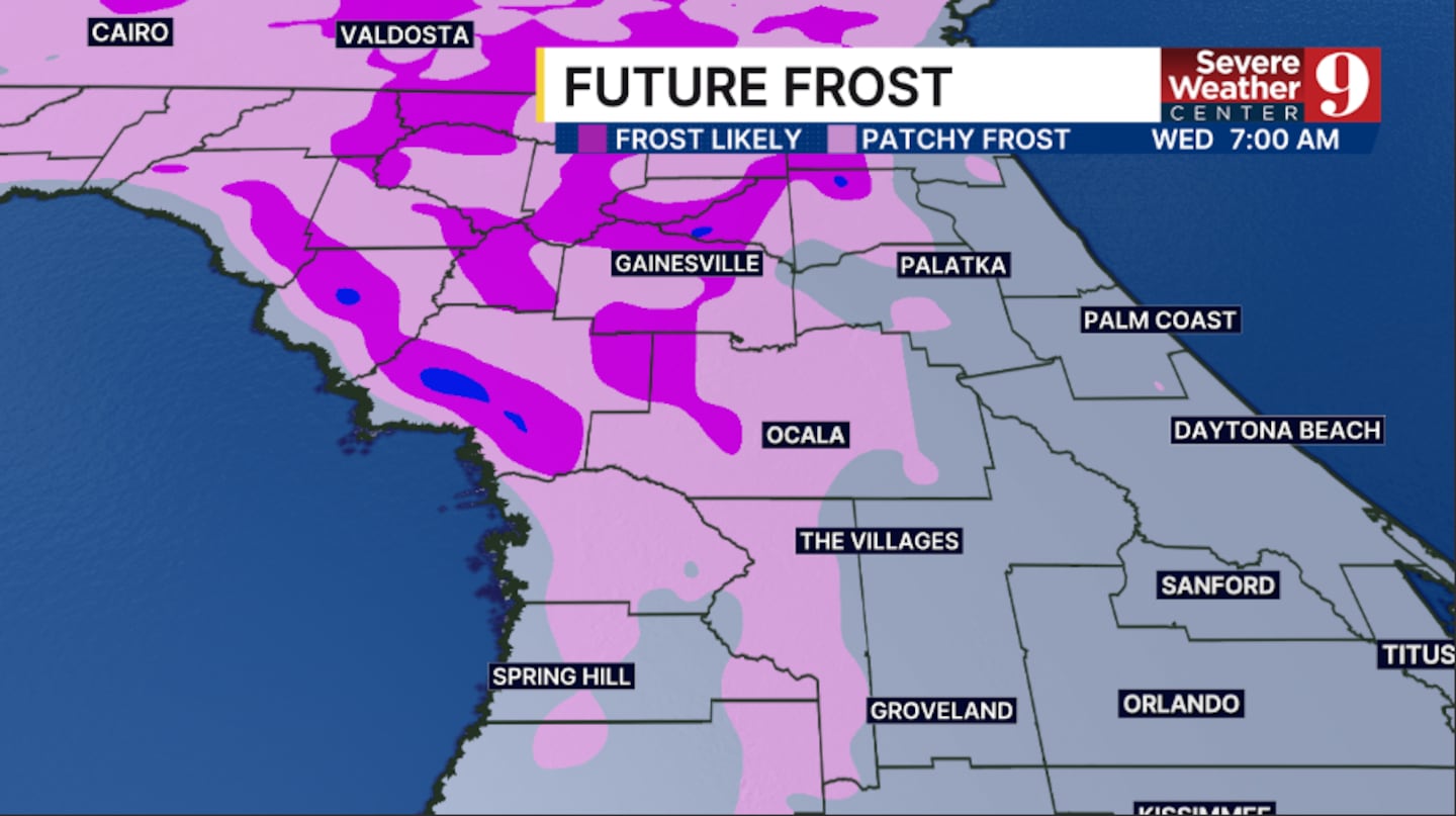
Tuesday night may bring the first frost to some areas as winds ease, potentially allowing frost to form in regions northwest of Orlando.
Morning temperatures will dip into the mid-40s.
Ahead of the front, we’ll see a mild night tonight with a stray sprinkle possible. Morning lows will be in the upper 60s.
It gets even warmer on Saturday as more warm air pushes in. Temps will climb into the mid-80s with just an isolated shower possible.
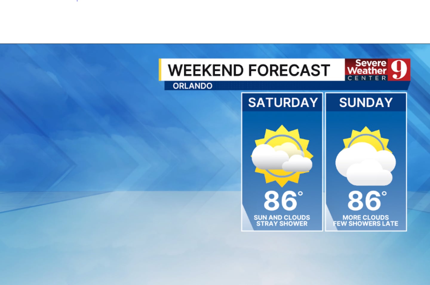
Rain chances will increase late Sunday into Sunday night as the strong front approaches. A few showers and possibly storms could develop, with highs Sunday in the low 80s.
Stay with Severe Weather Center 9 for the latest on the chilly blast for next week.
Click here to download our free news, weather and smart TV apps. And click here to stream Channel 9 Eyewitness News live.

©2025 Cox Media Group


