
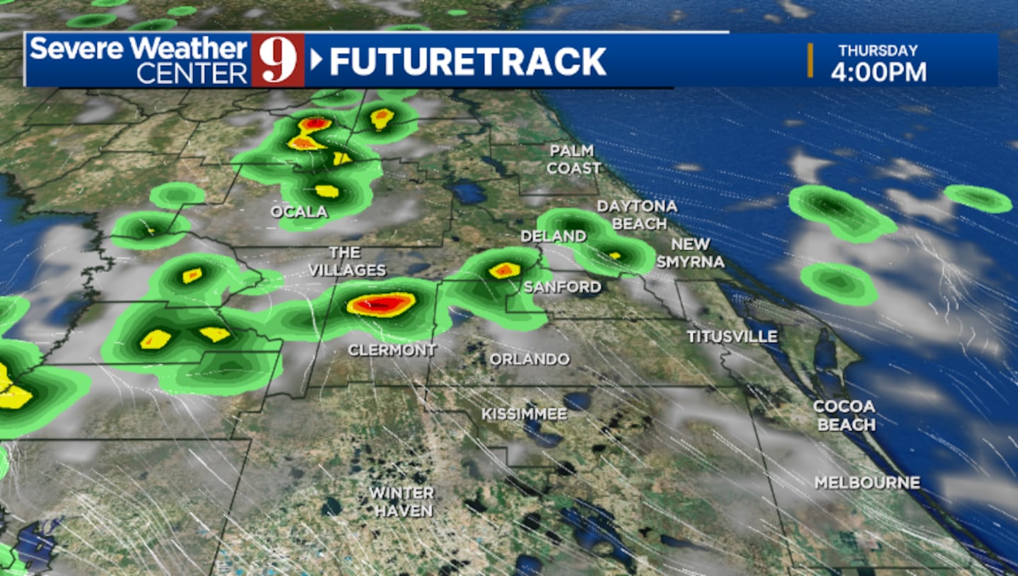
ORLANDO, Fla. — A flood advisory has been issued for portions of Lake and Orange counties until 5 p.m. The National Weather Service says between 2 and 2.5 inches of rain have fallen. Additional rainfall amounts of 1 to 2 inches are expected over the area.
4:04 PM | A Flood Advisory has been issued for portions of Lake, Orange Counties until 5:00 PM EDT. Between 2 and 2.5 inches of rain have fallen. Additional rainfall amounts of 1 to 2 inches are expected over the area. #FLwx pic.twitter.com/amGZDHVrp1
— NWS Melbourne (@NWSMelbourne) July 23, 2025
It’s been another day of showers and storms, but changes are on the way starting Thursday.
The showers and storms will fade away this evening, with quiet conditions overnight. Expect morning temps in the mid 70s.
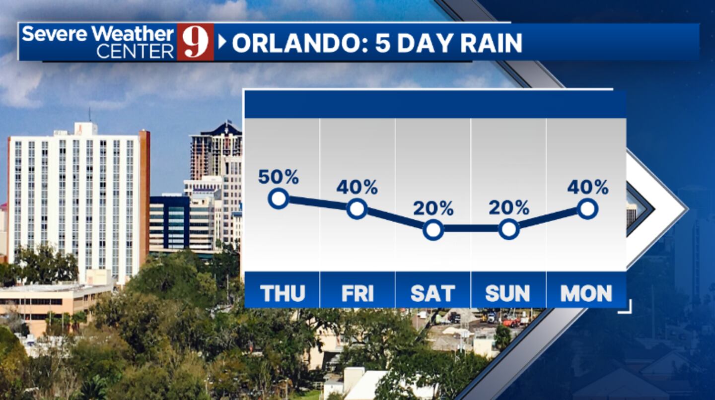
Some drier air moves in starting Thursday. This will lower coverage of rain and storms some, but many areas will still see rainfall. Highs for Thursday will be in the low 90s.
Even more dry air marches in for Friday. This will result in more scattered showers and storms, with temps in the low 90s.
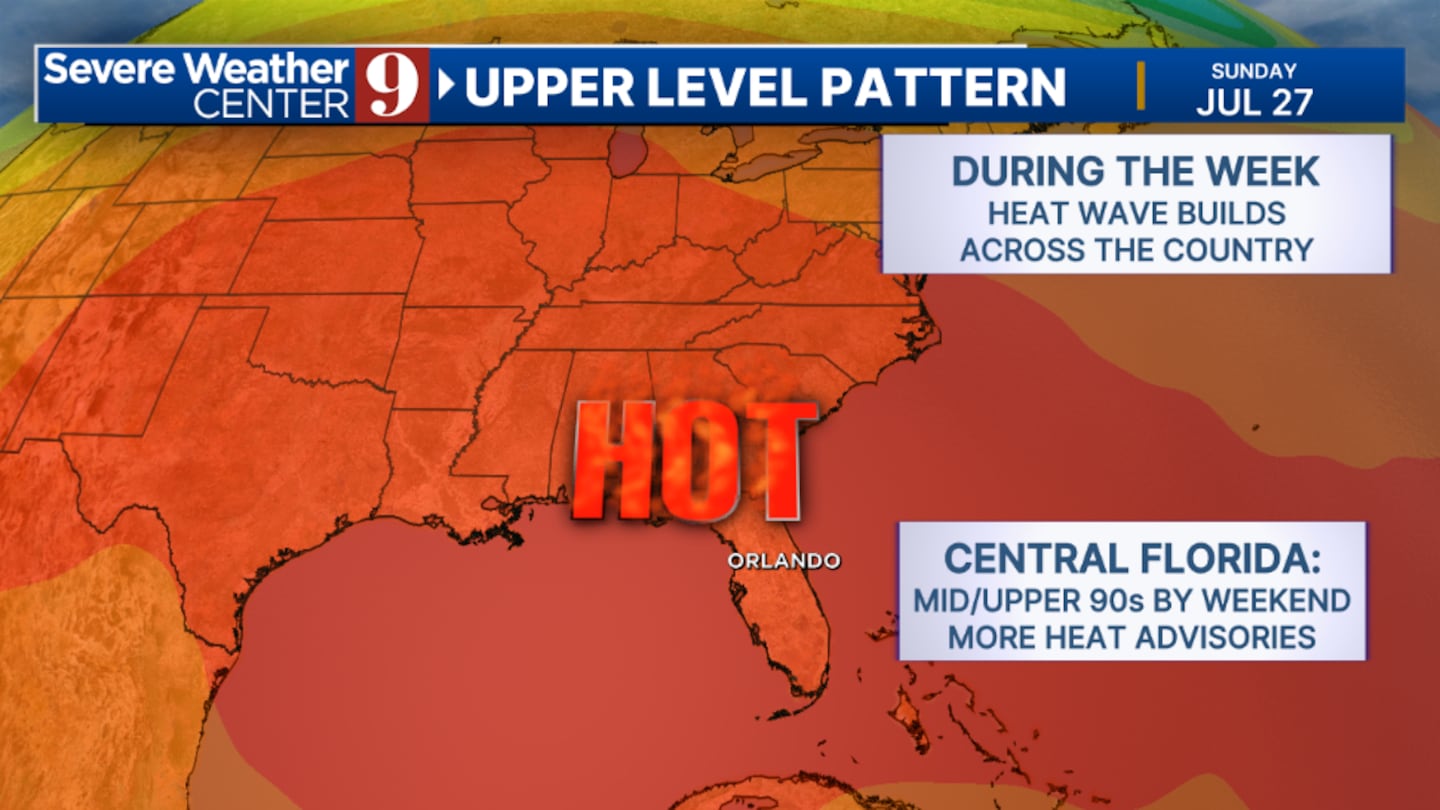
The heat returns in a big way for the weekend. Partly cloudy skies will develop both Saturday and Sunday, with just an isolated shower expected. Highs for the weekend will be in the mid to upper 90s, with heat indices above 105.
The heat looks to remain in place for next week. We’ll see slightly higher coverage of rain and storms, with highs in the mid to upper 90s.
Click here to download our free news, weather and smart TV apps. And click here to stream Channel 9 Eyewitness News live.

©2025 Cox Media Group


