
ORLANDO, Fla. — The National Hurricane Center confirmed Tuesday that Tropical Storm Jerry formed in the western Atlantic.
NHC said this is the tenth named storm of the 2025 Atlantic Hurricane Season.
Jerry will likely gain strength in the coming days.
The showers and thunderstorms will gradually become better organized as they enter the warm water of the central Atlantic.
The system is still projected to move west-northwest until the beginning of the weekend.
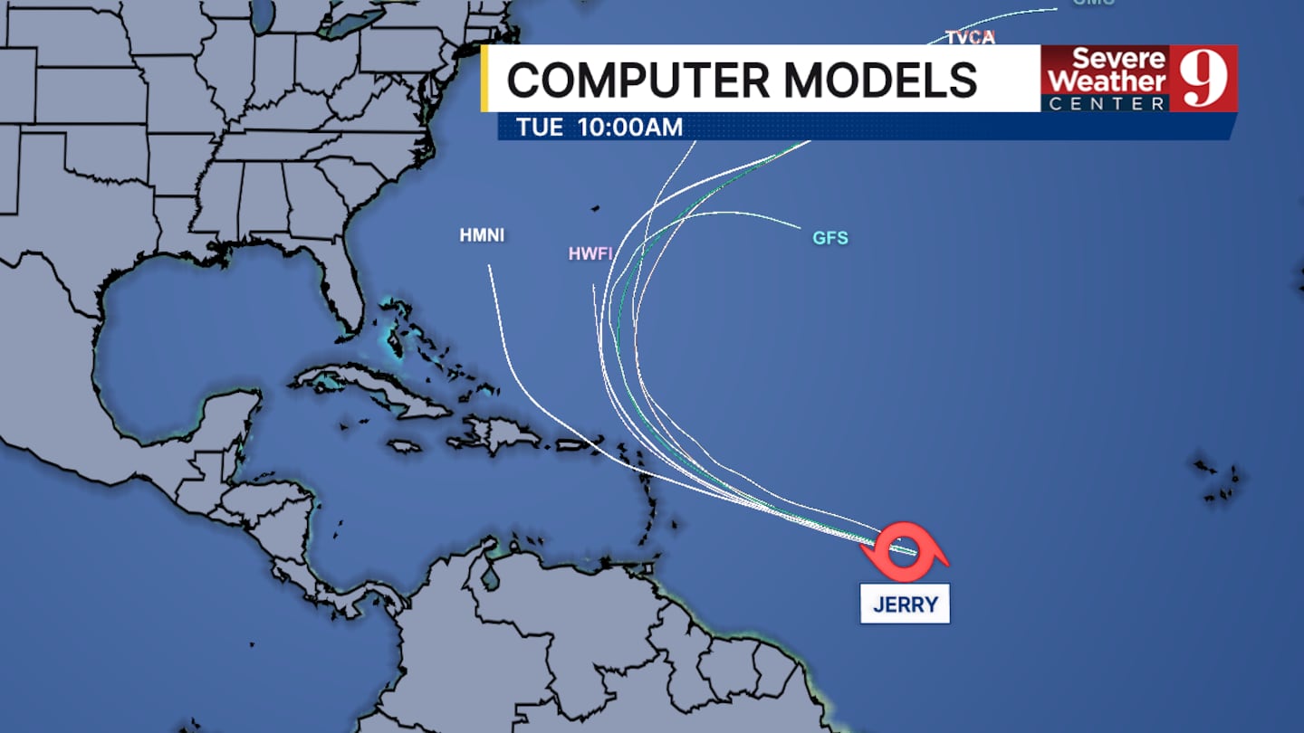
At that point in time, it will make a sharp northern turn before it can make landfall in the Leeward Islands.
There isn’t much agreement on how strong this storm could become. Half the models predict it will stay a tropical storm, while a few believe it could turn into a major hurricane by the end of the weekend.
The only thing everyone agrees on is the way it will move. It will follow a path similar to Humberto and curve before reaching the East Coast. Most models show it turning before it gets to Bermuda.
It is still early in the development cycle of Jerry.
Channel 9 will continue to monitor the situation with the storm and provide updates as needed.
Click here to download our free news, weather and smart TV apps. And click here to stream Channel 9 Eyewitness News live.

©2025 Cox Media Group


