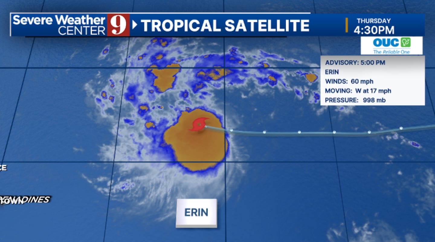
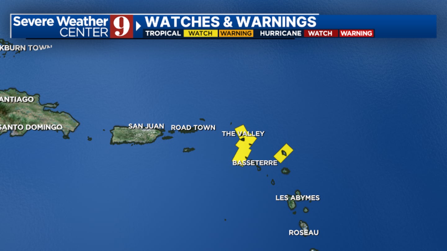
ORLANDO, Fla. — Tropical Storm Erin continues to move quickly westward in the open Atlantic, with watches now posted for parts of the Lesser Antilles.
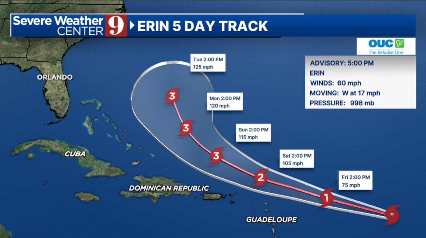
The 5 pm advisory from the National Hurricane Center has winds with Erin of 60 mph.
Tropical Storm Watches are now in effect for the northern Lesser Antilles, and additional watches are possible for the Virgin Islands and Puerto Rico.
Strengthening is forecast over the next 1-2 days, and the system is expected to become a hurricane on Friday.
The storm is expected to slowly turn to the west-northwest tonight into the weekend.
Erin is likely to move near or just north of the northern Lesser Antilles this weekend.
Long-term, Erin is expected to eventually turn to the north and could pass between the east coast of the United States and Bermuda next week.
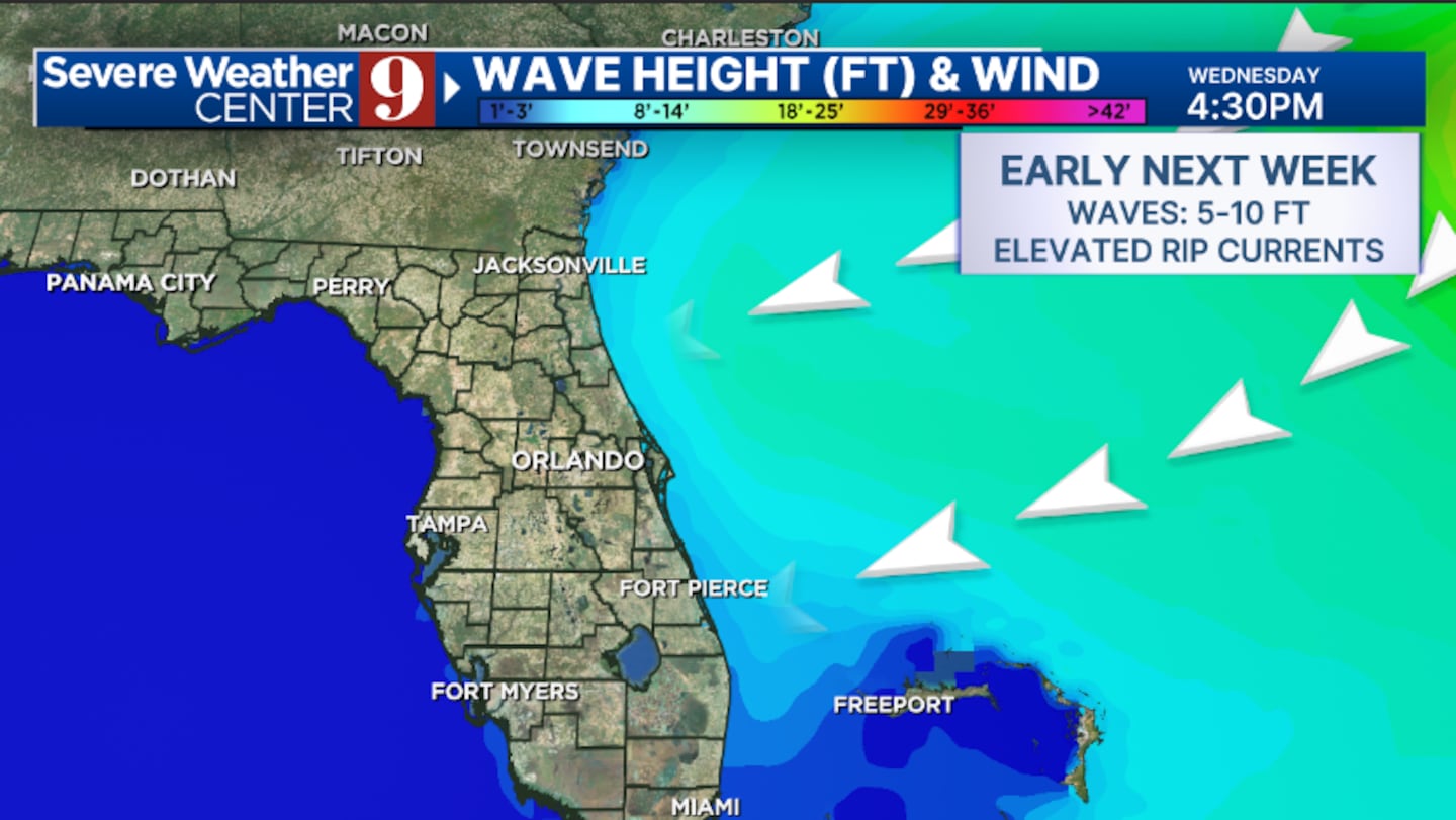
Erin is expected to stay well east of Florida as it makes a northward turn.
The east coast of the state will likely deal with large swells and dangerous rip currents early next week from the system.
Erin is the fifth named storm of the Atlantic hurricane season and is scheduled to be the first hurricane of the season.
Stay with Severe Weather Center 9 for the latest on the tropics.
▶ WATCH CHANNEL 9 EYEWITNESS NEWS

Click here to download our free news, weather and smart TV apps. And click here to stream Channel 9 Eyewitness News live.
©2025 Cox Media Group