
ORLANDO, Fla. — Severe Weather Center 9 is now monitoring the potential for tropical activity near Florida as the July 4th holiday approaches.
The National Hurricane Center has highlighted parts of the Gulf Coast and sections of the East Coast for the potential for tropical development in the following seven days.
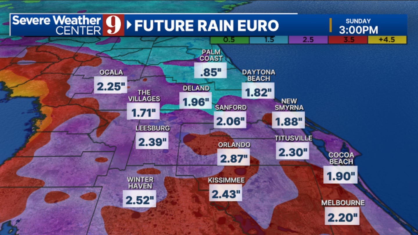
Late in the week, a trough of low pressure will begin to push toward the eastern Gulf, Florida, and the Atlantic.
This trough will bring significant moisture into the area, resulting in elevated rain and storm chances.
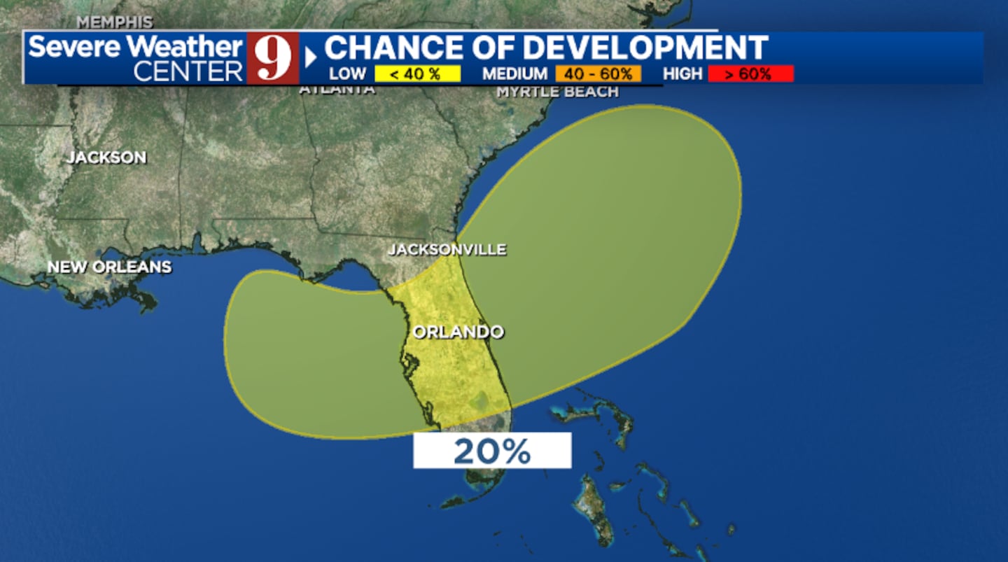
As the trough sits over the warm waters of the Gulf and the Atlantic, a surface low pressure could develop.
Should this occur, the low-pressure area could become tropical or subtropical, resulting in a tropical depression or a tropical storm.
There is high uncertainty about how this trough will evolve, and heavy rainfall may be the biggest threat to the July 4th holiday.
The latest computer guidance indicates widespread 2” amounts across the region, with much heavier rainfall possible.
Stay with Severe Weather Center 9 for the latest on the tropics over the next several days.
Click here to download our free news, weather and smart TV apps. And click here to stream Channel 9 Eyewitness News live.

©2025 Cox Media Group


