
ORLANDO, Fla. — Tropical Storm Erin is strengthening in the open Atlantic and will likely become a hurricane in the next 24 hours.
11:11 a.m. update:
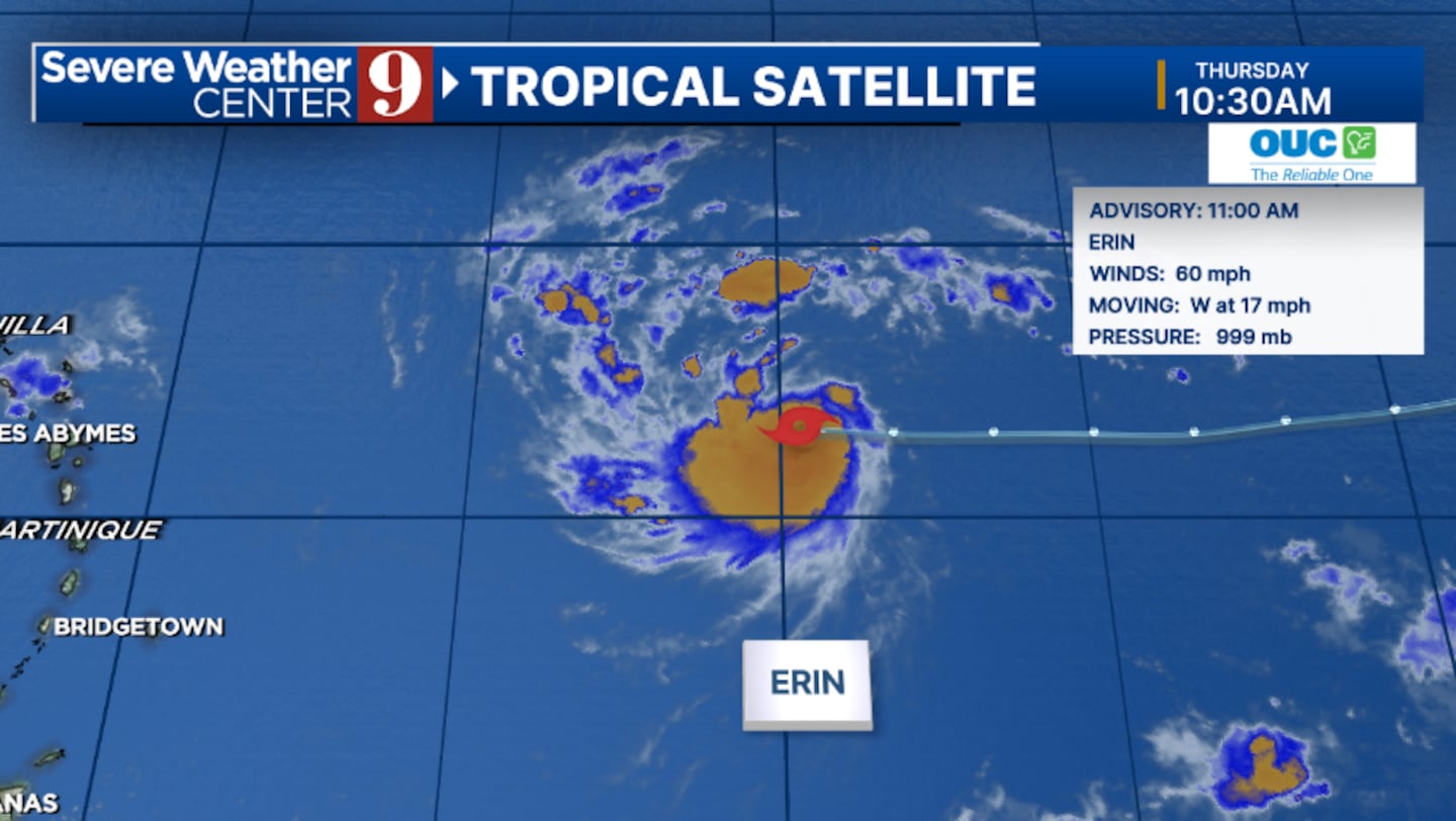
The 11 am advisory from the National Hurricane Center has increased winds with Erin to 60 mph.
Additional strengthening is forecast, and the system is expected to become a hurricane on Friday.
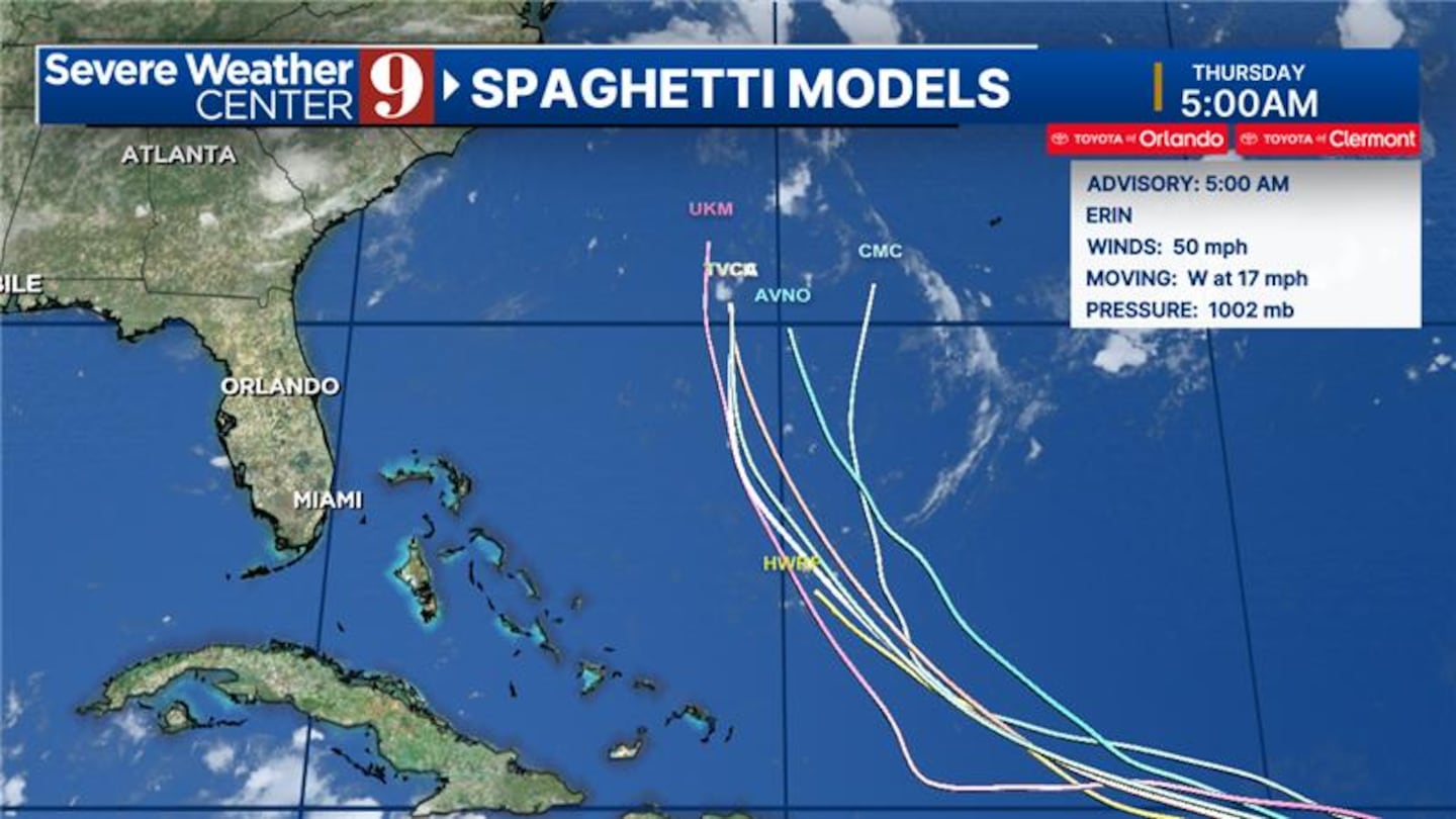
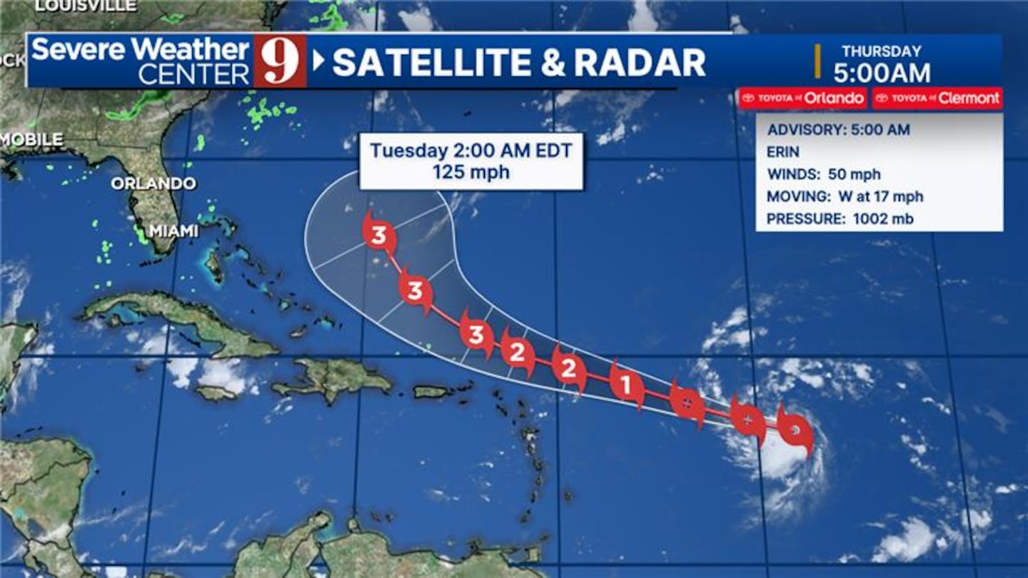
The storm is expected to continue to move westward, then slowly turn to the west-northwest tonight into the weekend.
Erin is likely to move near or just north of the northern Lesser Antilles this weekend.
Interests in the northern Lesser Antilles, the Virgin Islands and Puerto Rico should continue monitor the progress of Erin.
Long-term, Erin is expected to eventually turn to the north and could pass between the east coast of the United States and Bermuda next week.
#ERIN THU AM UPDATE:
— David Heckard (@DHeckardWFTV) August 14, 2025
Erin is starting to power up in the open Atlantic.
Winds are now 60 mph.
Not much change to the forecast - should pass N of Puerto Rico this weekend and then turn northward.
Could pass between US east coast and Bermuda.
Latest on @wftv #flwx #tropics pic.twitter.com/KHGe6R5Y5n
Erin is expected to stay well east of Florida as it makes a northward turn.
The east coast of the state will likely deal with large swells and dangerous rip currents early next week from the system.
Erin is the fifth named storm of the Atlantic hurricane season and is scheduled to be the first hurricane of the season.
Stay with Severe Weather Center 9 for the latest on the tropics.
Original report:
Tropical Storm Erin is expected to strengthen into the first hurricane of the 2025 season within the next 24 to 48 hours, potentially impacting the Caribbean region.
Erin is forecast to pass north of Puerto Rico and the Virgin Islands, bringing the potential for rough surf and periods of heavy rain this weekend.
As the storm progresses, it will likely turn north before reaching the Bahamas, keeping it away from Florida’s east coast.
The storm’s trajectory suggests that while Puerto Rico and the Virgin Islands will experience adverse weather conditions, Erin’s main path will remain to the north of these islands.
This positioning should mitigate the most severe impacts, though residents are advised to prepare for rough seas and significant rainfall.
Looking ahead to next week, Florida’s east coast is expected to avoid a direct hit from Erin.
However, the state will experience increasing surf conditions, with wave heights projected to reach between 5 to 7 feet by Wednesday.
Click here to download our free news, weather and smart TV apps. And click here to stream Channel 9 Eyewitness News live.

©2025 Cox Media Group


