
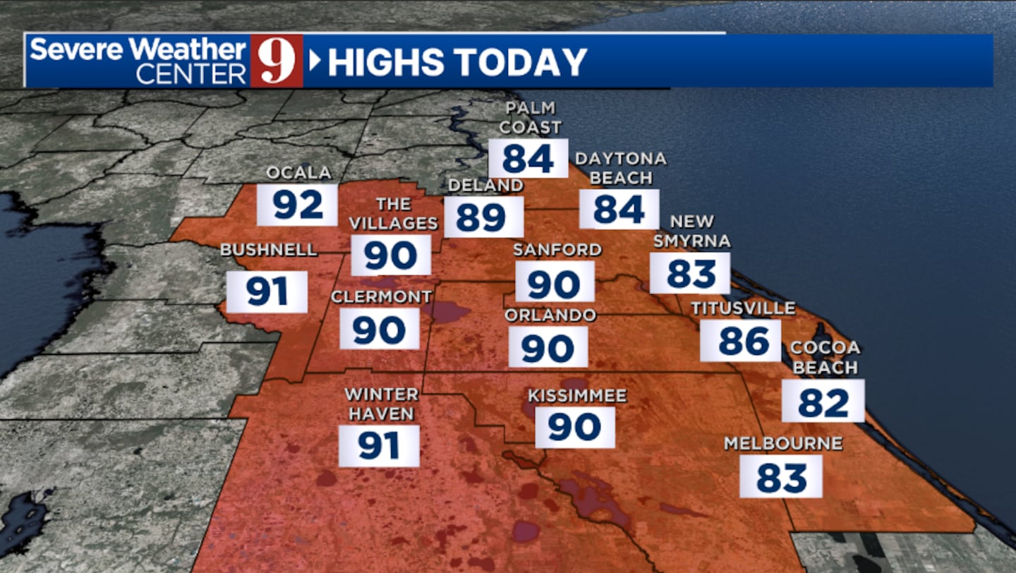
ORLANDO, Fla. — It’s another mild start to the day across Central Florida, and more warmth is ahead for Saturday.
We will again see a blend of sun and clouds across the area, with highs in the low 90s. A stray shower is possible in areas NW of Orlando, but most will remain dry.
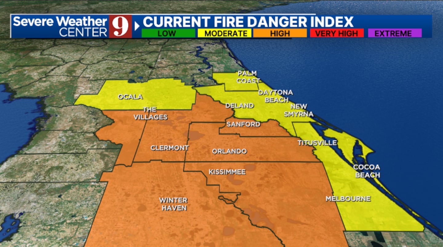
The wildfire threat remains elevated today, with the highest concern this afternoon in inland areas.
Expect quiet conditions overnight, with a few clouds. Morning lows will be in the mid-60s.
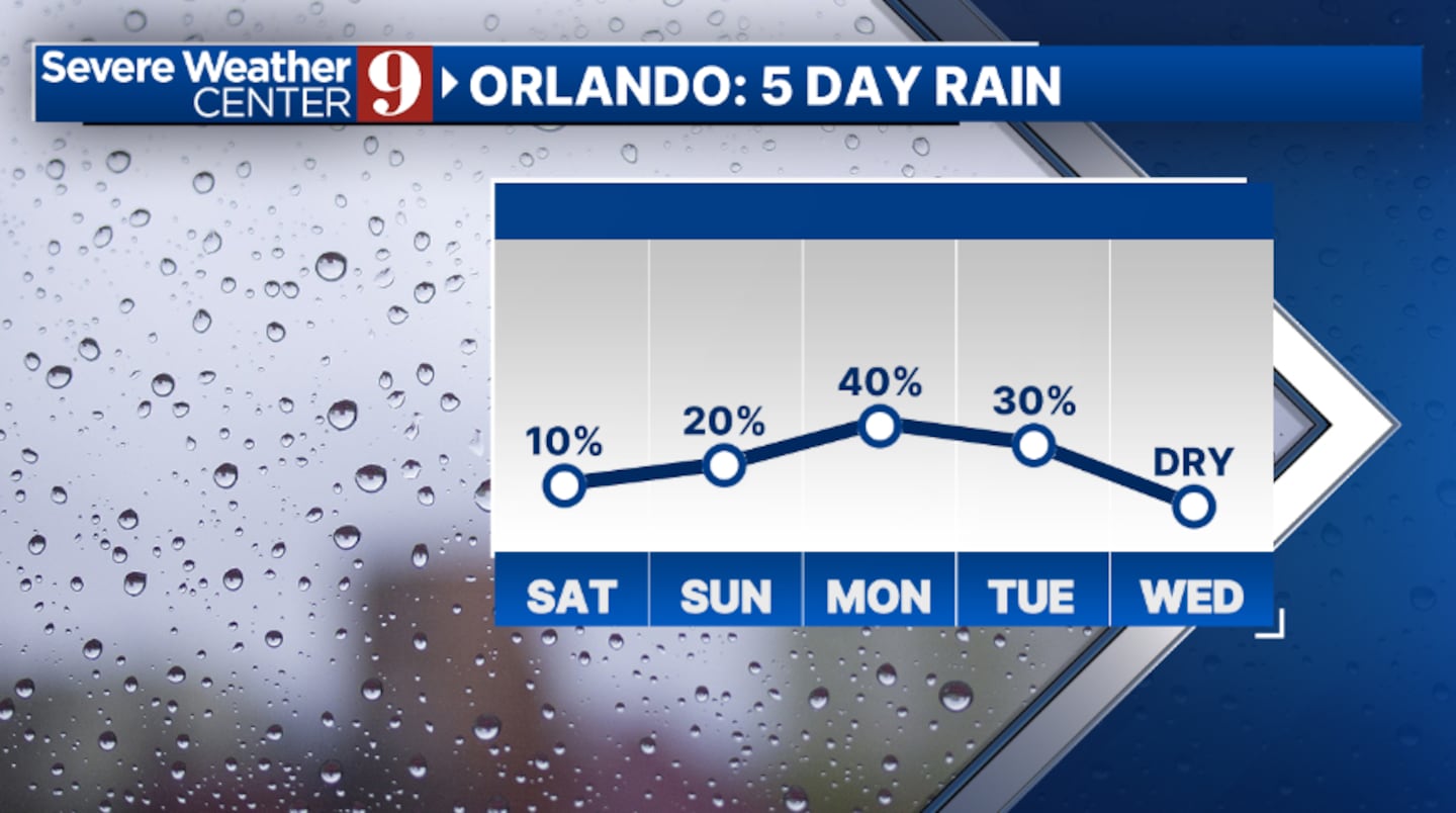
Slightly higher rain chances move in for Sunday. The best opportunity for activity will be in the PM hours, with highs again in the low 90s.
Even more moisture pushes in to start next week. Scattered showers and a few storms are likely for Monday afternoon and evening, with highs in the low 90s.
Tuesday may bring more much-needed rain, with scattered showers again developing. Temperatures will be in the mid-80s.
Drier air does move back into the area for the back end of next week, with highs in the upper 80s and low 90s.opportunity
Click here to download our free news, weather and smart TV apps. And click here to stream Channel 9 Eyewitness News live.

©2025 Cox Media Group


