
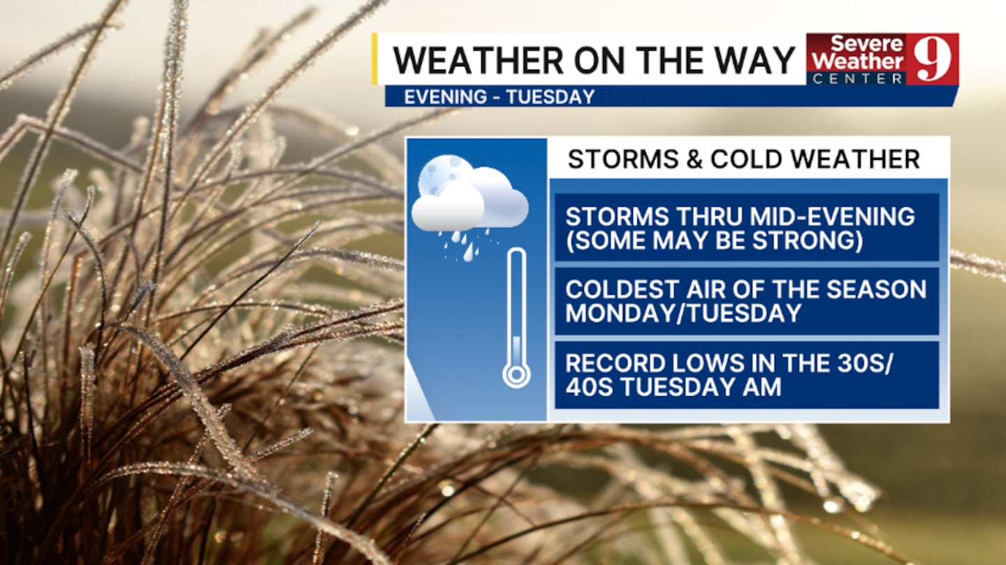
ORLANDO, Fla. — We have Weather On the Way for this evening, Tuesday, with the threat of storms and the coldest air of the season impacting the area.
A strong cold front continues to push toward the region tonight. Additional scattered storms will be possible through mid-evening, and an isolated strong storm can’t be ruled out. Overnight lows will be in the low 60s.
Behind the front early Monday morning, the coldest air of the season plunges into the region. Highs on Monday are expected to be in the mid-60s, accompanied by strong northerly winds.
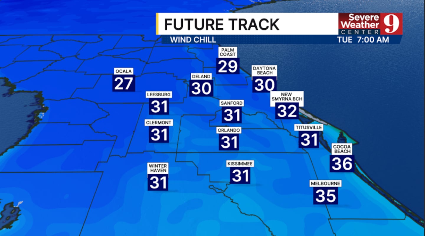
It now appears that much of the area will experience record to near-record lows on Tuesday morning.
A Freeze Watch has been posted for parts of Marion Co., and AM temps will fall into the 30s and 40s area-wide.
It feels like temperatures on Tuesday morning will be in the 20s and 30s, and a Cold Weather Advisory is likely for much of the region.
Tuesday remains the coldest day of the stretch, with highs struggling to climb into the upper 50s.
It is increasingly likely a widespread frost will occur in areas west and northwest of Orlando Wednesday morning. Morning lows will then be in the 30s and 40s with lighter winds.
Stay with Severe Weather Center 9 for the latest on the chilly blast over the next several days.
Click here to download our free news, weather and smart TV apps. And click here to stream Channel 9 Eyewitness News live.

©2025 Cox Media Group


