
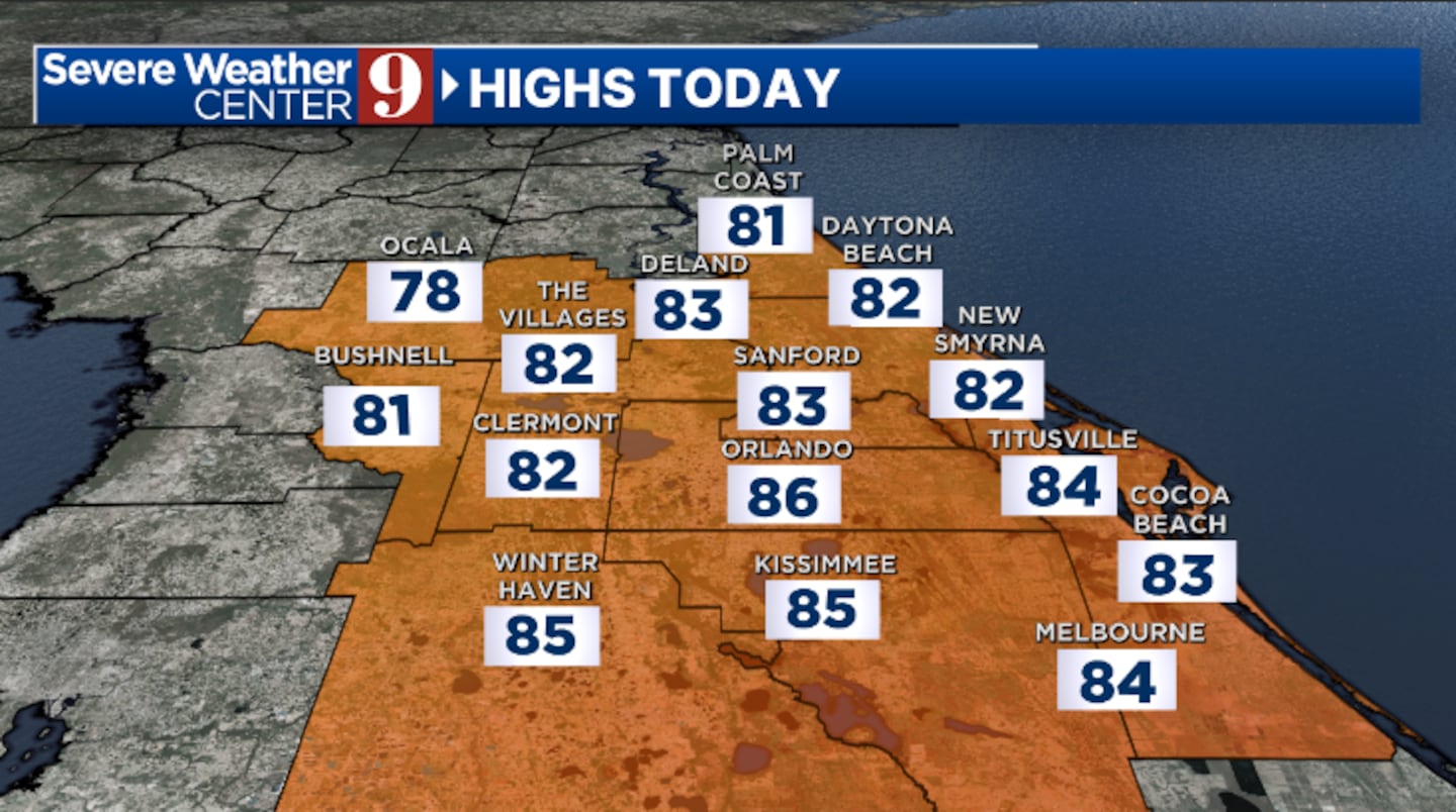
ORLANDO, Fla. — It is a quiet and warm start for Raceday at Daytona, but rain and storms will threaten the race this afternoon.
▶ WATCH CHANNEL 9 EYEWITNESS NEWS
Scattered showers and storms will enter the area this afternoon as a cold front arrives.
The worst of the rain for the Daytona 500 looks to be in the mid-to-late afternoon. It will be very windy, with wind gusts over 40 mph and highs in the low 80s.
Read: Mac McClung wins third consecutive NBA Dunk Contest
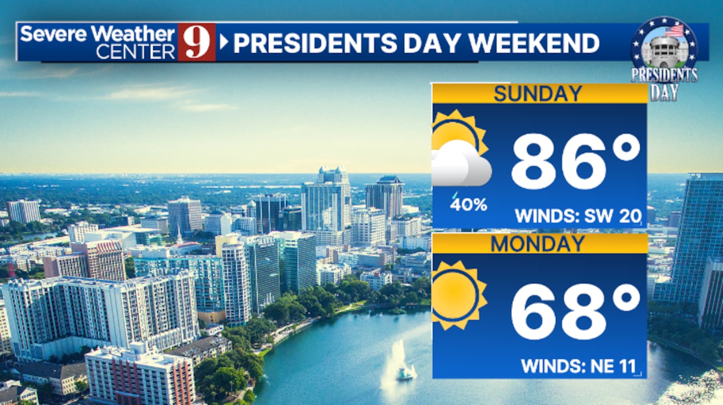
The rain will exit this evening, and clearing skies will cover the area. Behind the front, it will also be cooler, with morning lows in the low 50s.
Presidents Day will feature plenty of sunshine and cool temperatures. With dry conditions, Monday’s highs will only be in the upper 60s.
Read: Weekend Guide: 9 things to do in Central Florida
Warmer weather quickly returns on Tuesday, with just a few clouds. Temperatures will climb into the mid-70s.
Our next storm system arrives Wednesday, bringing the threat of rain and storms back into the area. Wednesday’s highs will be in the low 80s.
Read: ‘This plane is unrecognizable’: pilot killed in single plane crash in Flagler County
Another round of cooler temps is likely late week, with highs back down in the 60s.
Click here to download our free news, weather and smart TV apps. And click here to stream Channel 9 Eyewitness News live.

©2025 Cox Media Group


