
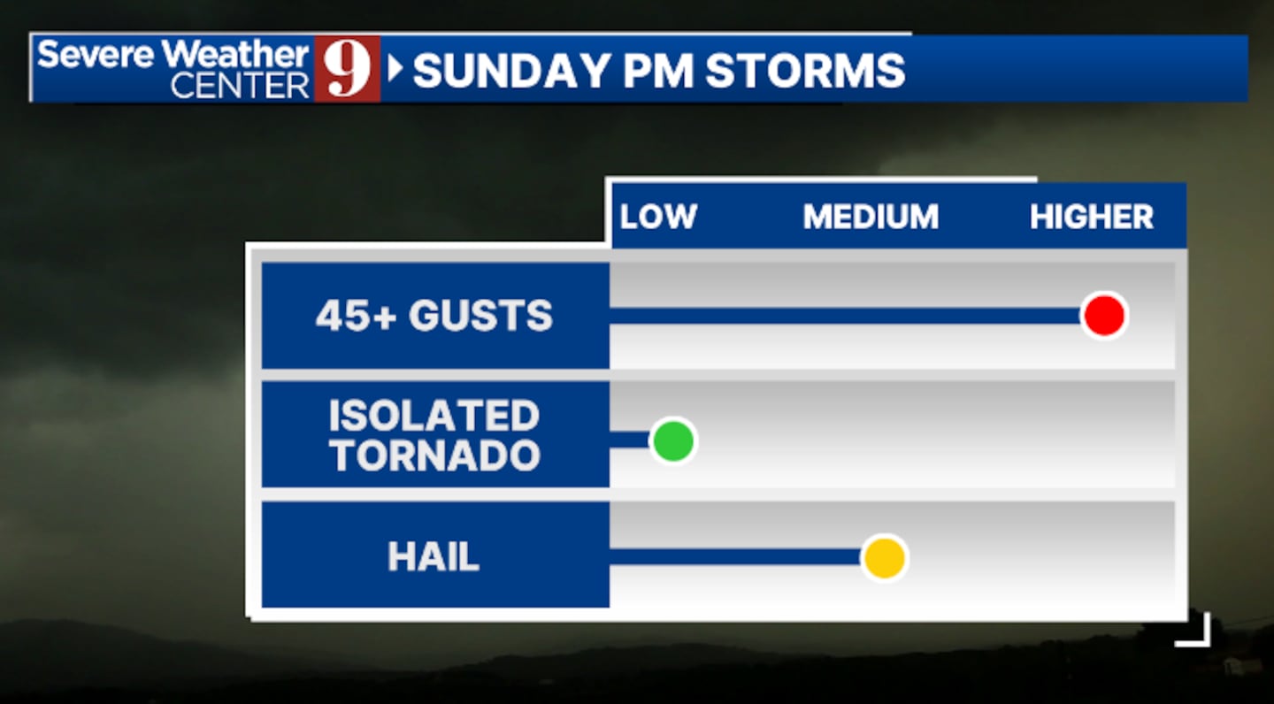
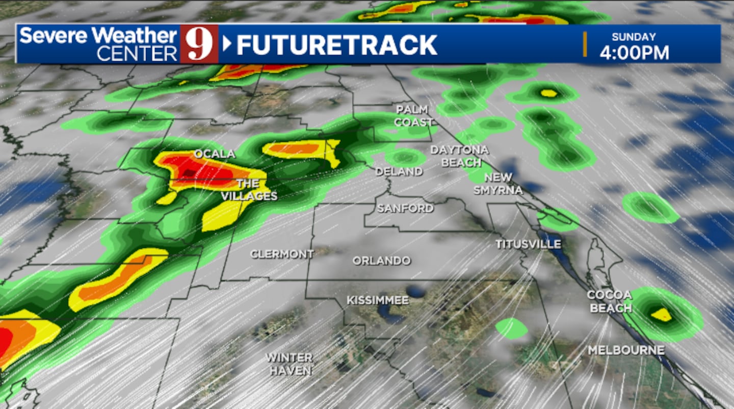
ORLANDO, Fla. — A Weather Alert Day is in effect for Sunday, as strong to severe storms will push into Central Florida this afternoon and evening.
The morning hours will be quiet, with showers and storms moving in during the afternoon and evening. Some storms may be strong to severe, with strong winds, hail, and isolated tornadoes being the biggest threats.
It will be windy throughout the day, with highs in the upper 80s.
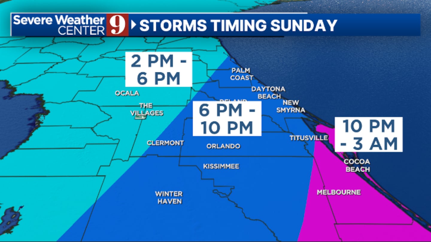
Rain and storms will slowly exit later tonight, with skies clearing by daybreak. Morning lows will be in the low 60s.
Much quieter and cooler weather is expected for St. Patrick’s Day Monday. We’ll see a heavy dose of sunshine, windy conditions and highs in the low 70s.
The tranquil weather will continue through midweek. Expect plenty of sun on Tuesday and Wednesday, with highs in the mid-70s and low-80s.
Our next cold front arrives Thursday, but just a few isolated showers are expected. Thursday’s temperatures will be in the low 80s.
It does turn cooler once again to close out the work week, with highs Friday in the low 70s.
Stay with Severe Weather Center 9 for continuous updates on the severe weather threat today.
Click here to download our free news, weather and smart TV apps. And click here to stream Channel 9 Eyewitness News live.

©2025 Cox Media Group


