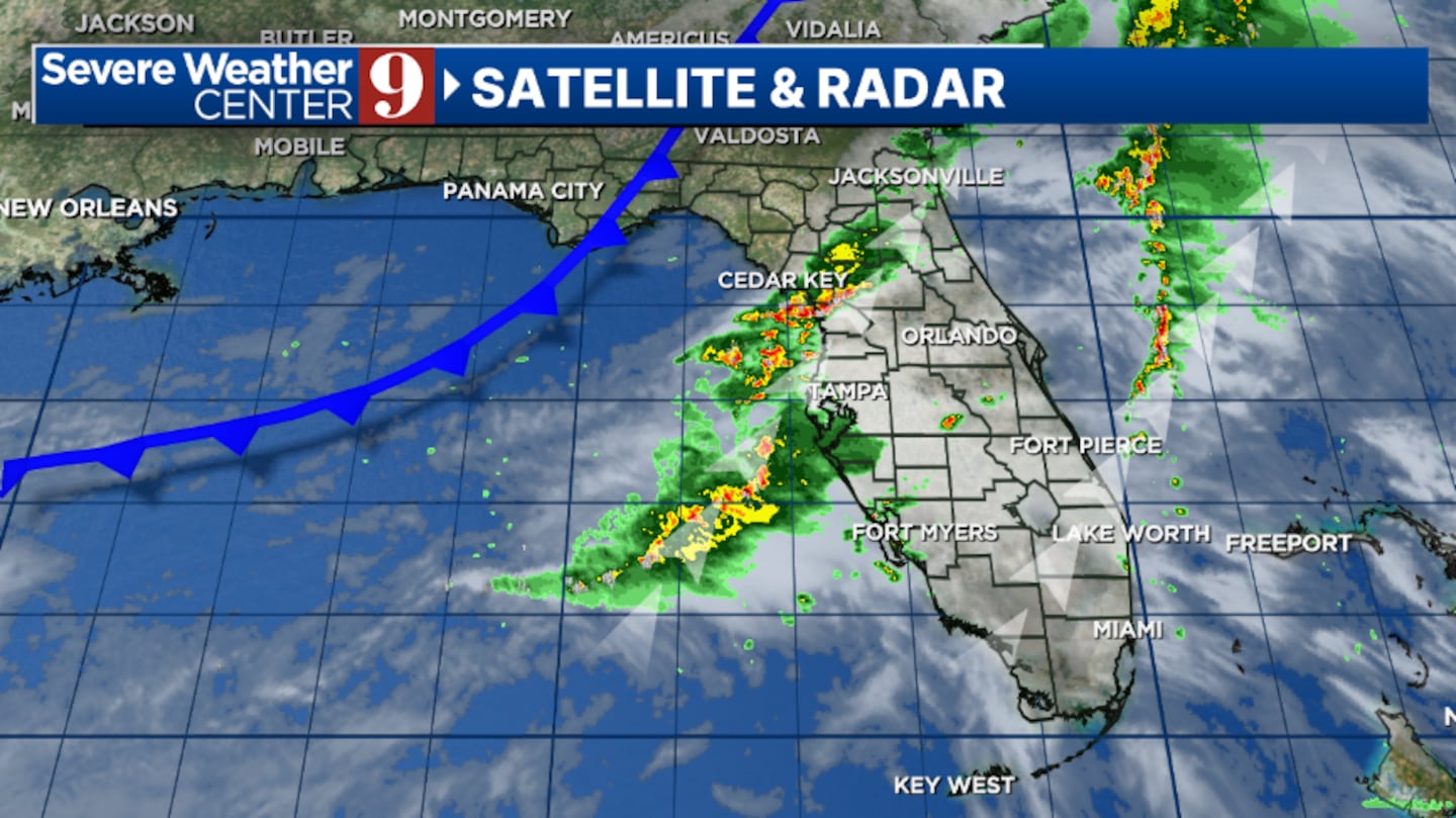
, Fla. — After a reasonably quiet Saturday, showers and storms will likely close the weekend.
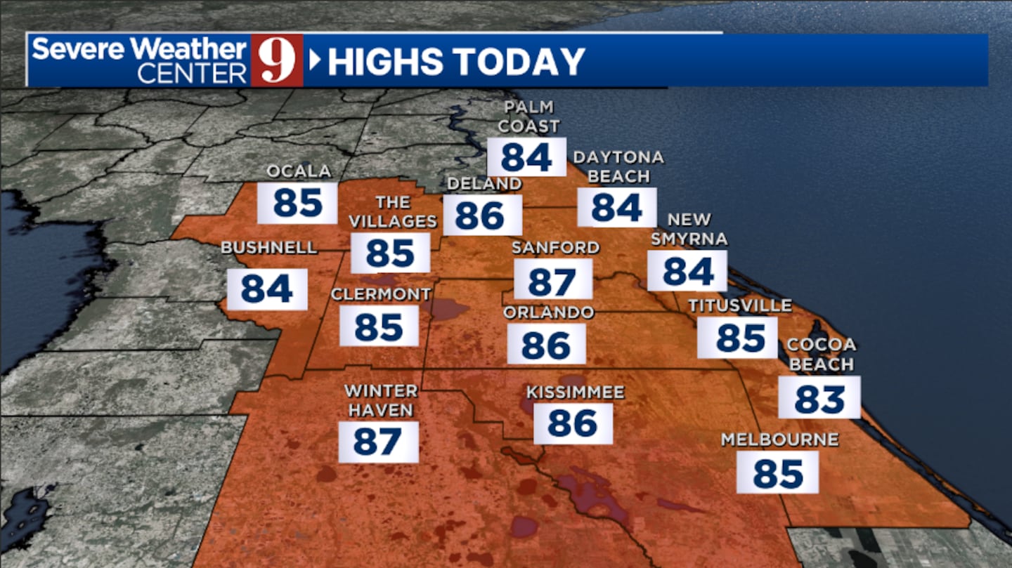
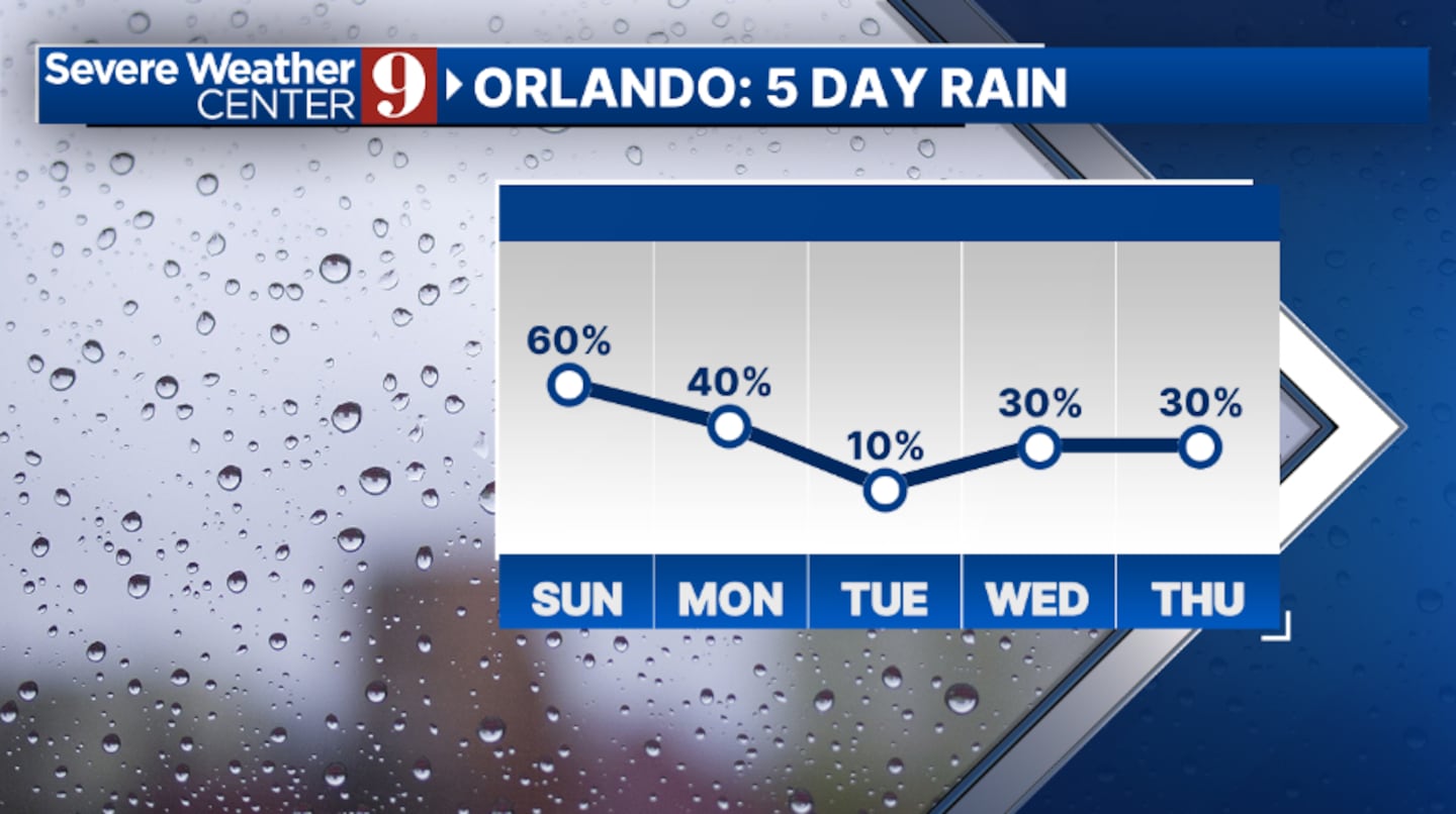
Scattered showers and storms will impact the area during the daytime, with a few intense storms possible. The greatest threats will be lightning, gusty winds, and hail. Sunday’s highs will be in the mid-80s.
The rain and storms will push into the Atlantic later tonight, with clouds decreasing. Morning lows will be in the upper 60s.
More rain and storms are likely to start the work week on Monday. The highest coverage will be in eastern areas, and a few strong storms will again be possible. Monday’s temperatures will be in the upper 80s.
Drier air moves into the area on Tuesday, and just an isolated shower is expected. Tuesday’s highs will be in the low 90s.
More rain and storms are likely midweek as moisture quickly returns to the region. Expect PM showers and a few storms both Wednesday and Thursday, with highs in the low 90s.
Our next storm system arrives for the tail end of the work week, bringing even higher rain and storm chances to the area.
Click here to download our free news, weather and smart TV apps. And click here to stream Channel 9 Eyewitness News live.

©2025 Cox Media Group