
ORLANDO, Fla. — It’s shaping up to be an active weather day across the area on Sunday, with strong storms possible.
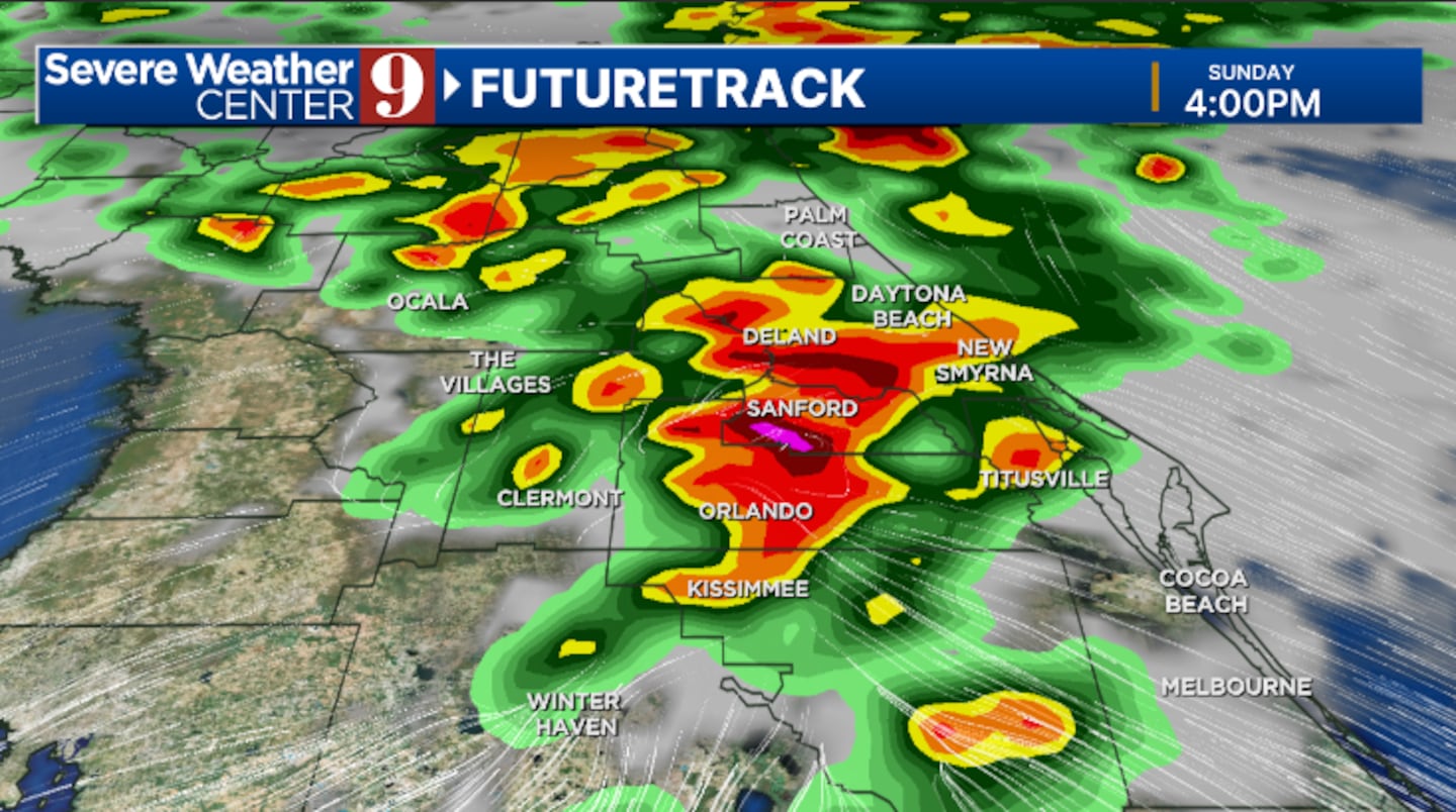
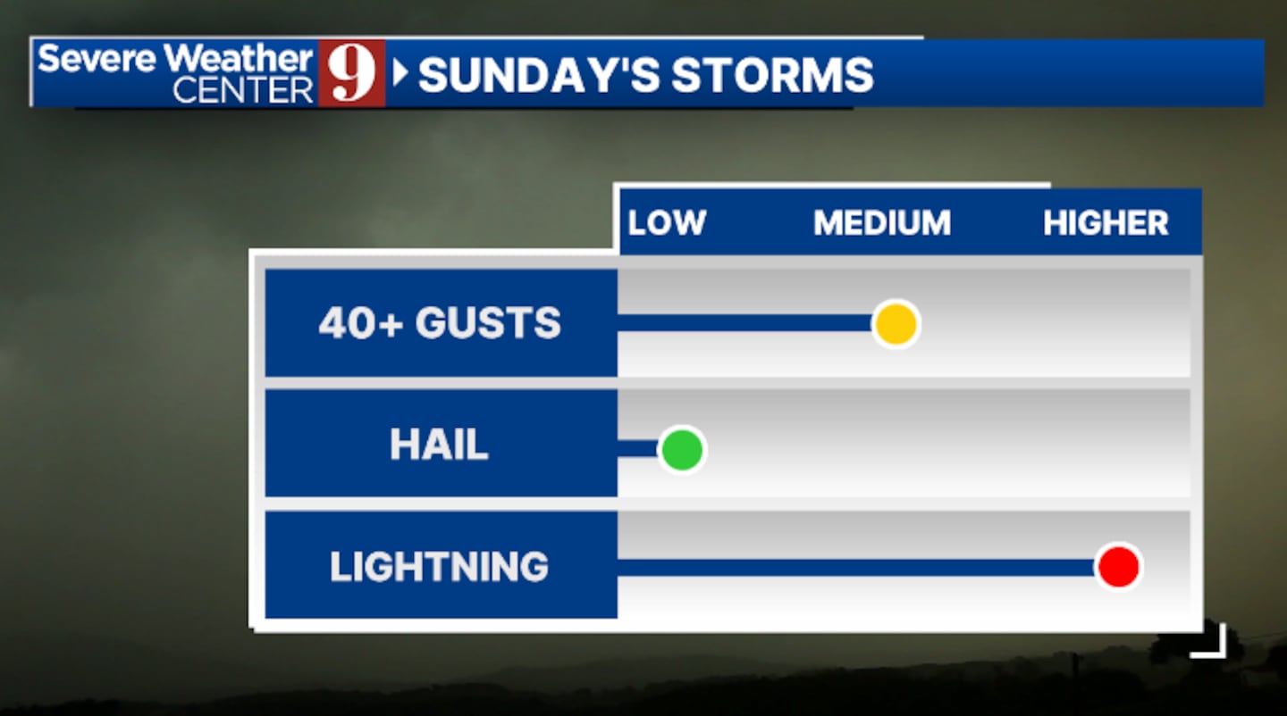
Scattered showers and storms will be possible in the morning, but the best chance for activity will be in the afternoon and early evening. Some storms may be strong, with gusty winds, hail, lightning, and heavy rains the biggest threats.
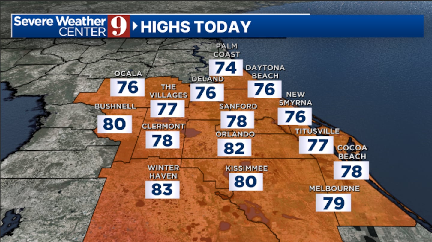
Sunday’s highs will be in the low 80s.
The rain and storms will wind down later this evening, with some clearing. Morning lows will be in the upper 60s.
Lower rain and storm chances will return on Monday. Scattered activity will develop during PM hours, with strong storms possible north of Orlando. Monday’s highs will be in the upper 80s.
More scattered showers and storms will be possible midweek. Expect a quiet morning, with scattered activity developing each afternoon. Temps for Tuesday and Wednesday will be in the upper 80s.
A few isolated showers are possible late in the week as temperatures warm even further across the region. Thursday and Friday’s highs will push into the low 90s.
Click here to download our free news, weather and smart TV apps. And click here to stream Channel 9 Eyewitness News live.

©2025 Cox Media Group


