ORLANDO, Fla. — It was an active start to the weekend across the area, and Sunday will likely see more rain and storms.
The rain and storms will slowly come to a close this evening, with variable clouds overnight. A few showers will be possible northwest of Orlando towards daybreak, with morning lows in the mid-70s.
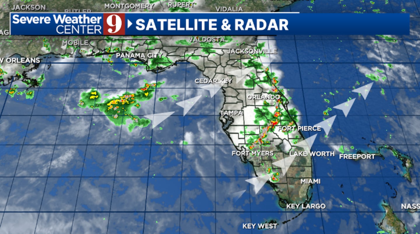
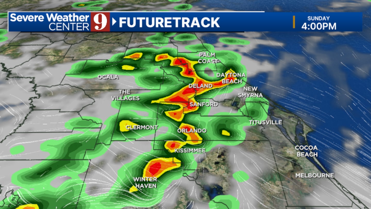
Our tropical moisture remains in place for Sunday, meaning elevated rain and storm chances once again. The best chance for activity will be in the afternoon and early evening hours, with highs in the low 90s.
Even more moisture will push in to start next week, resulting in higher coverage of PM rain and storms for Monday. Temps to start the week will be in the upper 80s.
The moisture now looks to ease some by mid-next week, but decent coverage of showers and storms is still expected. Tuesday and Wednesday’s highs will be in the low 90s.
Another round of moisture will likely move in for Thursday and the July 4th holiday. While there is some uncertainty, high coverage of rain and storms is possible both days, with highs in the upper 80s.
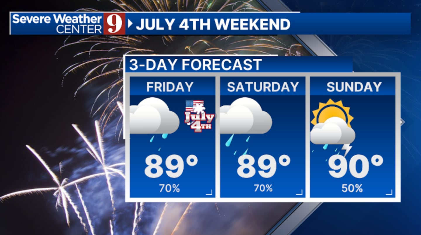
More daily rain and storms are expected for the back end of the holiday weekend.
Click here to download our free news, weather and smart TV apps. And click here to stream Channel 9 Eyewitness News live.

©2025 Cox Media Group