ORLANDO, Fla. — It’s been an unsettled weekend across the Orlando area, and more Orlando weather is on the way ahead for Monday.
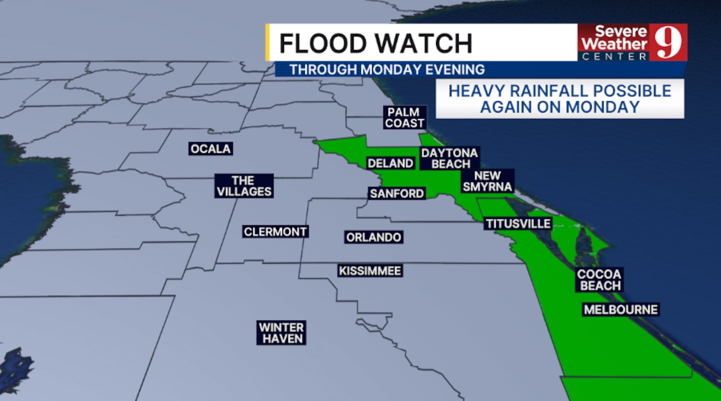
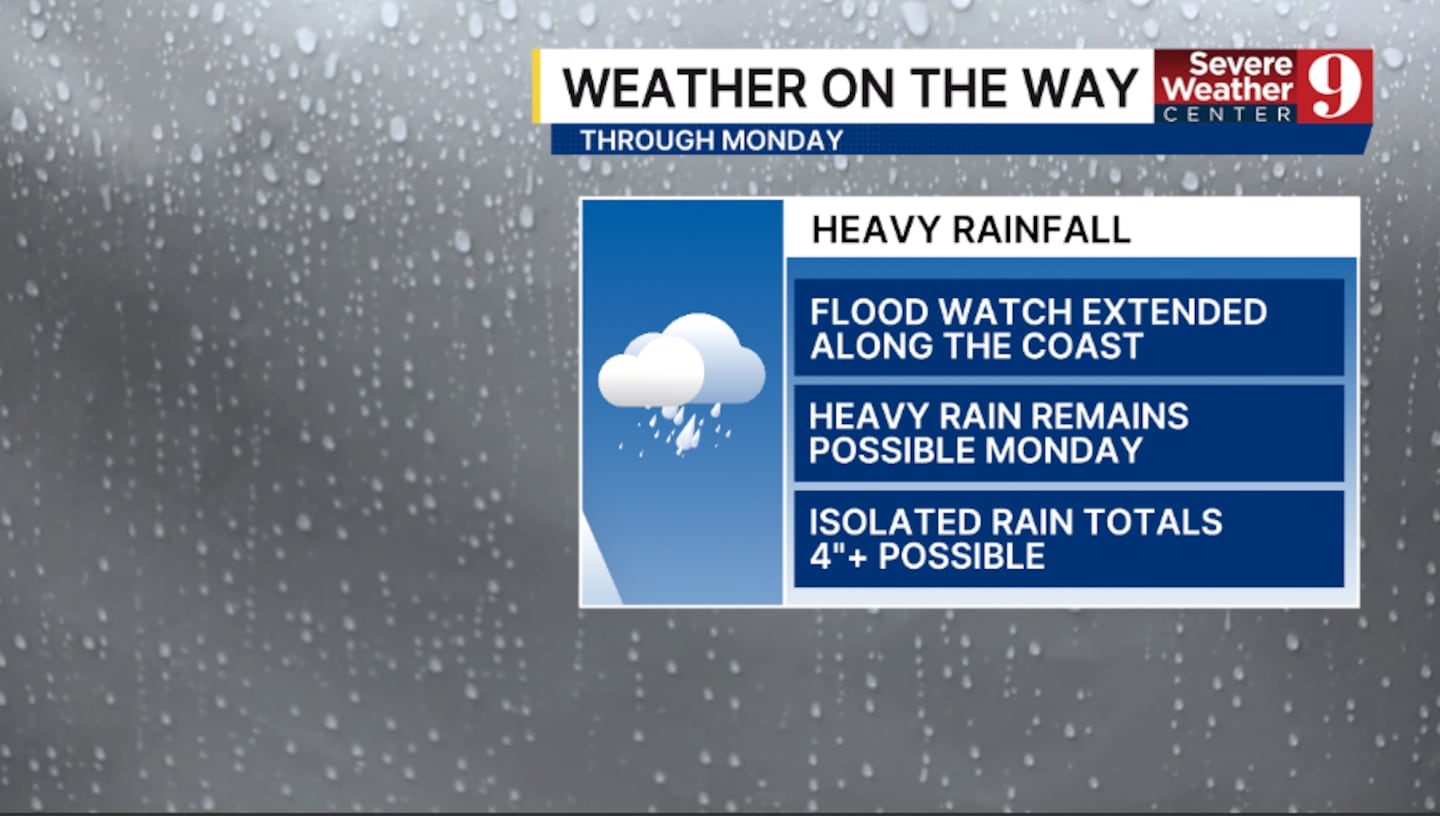
The Flood Watch for coastal areas has been extended into Monday, as the threat of flooding concerns will linger in Central Florida.
The rain and storms will diminish some this evening, but scattered activity remains possible overnight. Morning lows will be in the mid 70s.
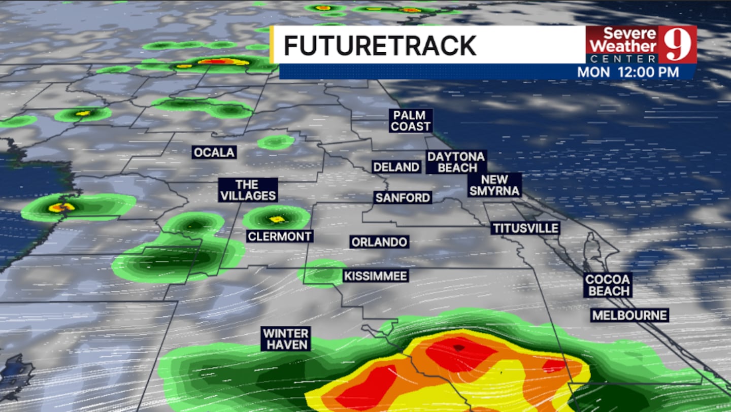
More active Orlando weather forecast is ahead for Monday. Once again, periods of rain and storms will develop with heavy rainfall possible. Highs to start the week will be in the mid 80s.
Drier air quickly rushes in for Tuesday, reducing coverage of the rain. Just scattered showers and storms are expected, with temps in the upper 80s.
More dry air arrives midweek, resulting in just isolated rain chances Wednesday. Highs will push into the upper 80s.
The moisture does return late week, bringing higher coverage of rain and storms back into the Orlando region.
Stay with Severe Weather Center 9 for the latest on the heavy rainfall threat on Monday.
Click here to download our free news, weather and smart TV apps. And click here to stream Channel 9 Eyewitness News live.

©2025 Cox Media Group


