ORLANDO, Fla. — It was a warm and lively weekend, but some changes are coming for the work week.
The showers and storms will fade again later this evening, leaving just a few clouds overnight. Expect lows in the mid 70s in the morning.
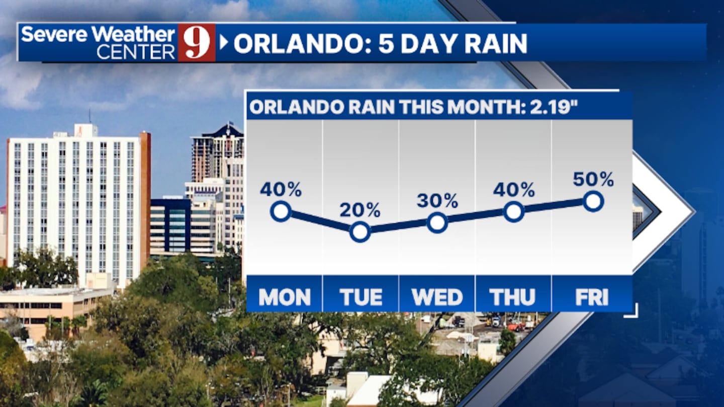
Lower rain and storm chances are expected on Monday. Some activity will develop, but coverage will be lower than on Sunday. Highs to start the workweek will be in the low 90s.

Even drier air moves in as Erin heads north in the open Atlantic. This will only bring a small chance of storms on Tuesday and Wednesday, with warm highs in the mid-90s.
As Erin moves away, tropical moisture quickly spreads into the area, increasing rain chances. Expect widespread rain and storms later in the week, with temperatures in the low 90s.
There is some uncertainty about next weekend, but for now, PM showers and storms seem likely.
Click here to download our free news, weather and smart TV apps. And click here to stream Channel 9 Eyewitness News live.

©2025 Cox Media Group