
ORLANDO, Fla. — 11 p.m. update:
Invest 93L is still moving toward our east coast and will slide westward over the state on Tuesday, and over the eastern Gulf.
The organization’s prospects are increasing (40%) once it gets over warm Gulf waters later this week, and it will likely trek toward the LA/MS coast by Thursday.
Our impacts remain likely rain and storms on Tuesday as it passes, with a few storms possibly severe with locally heavy rain, not that different from our ordinary storms.
We’ll keep an eye out for any rotation in storms since we’ll be near the system itself.
Original Story:
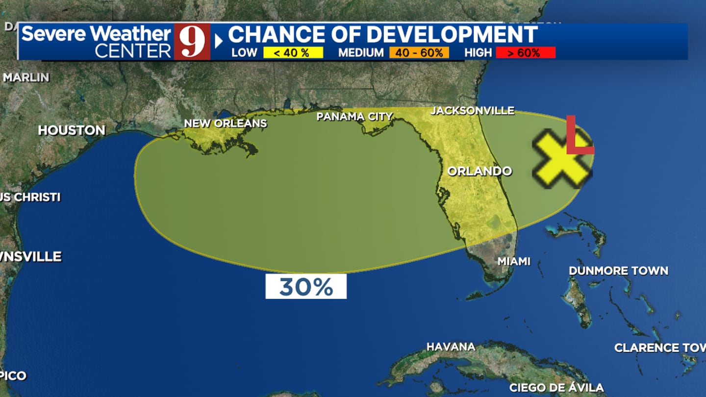
Newly formed #93L is spinning off Florida’s east coast, and will trek over Florida on Tuesday and over the very warm Gulf where it may develop later this week as it moves away from us.
#Dexter is the next name in the list.
Currently, the NHC has a 30% chance of formation
For central Florida, we’ll be monitoring for any development in the new system as it moves overhead and away from us through mid/late week.
We’re continuing to see bands of downpours mixed in with the typical afternoon storm pattern bringing high rain chances the next few days.
Click here to download our free news, weather and smart TV apps. And click here to stream Channel 9 Eyewitness News live.

©2025 Cox Media Group


