
ORLANDO, Fla. — It was a warm end to the weekend and more warmth and higher rain chances are on the way for the work week.
The scattered showers and storms will quickly end this evening and quiet conditions are expected overnight. Morning temperatures will be in the mid-70s.
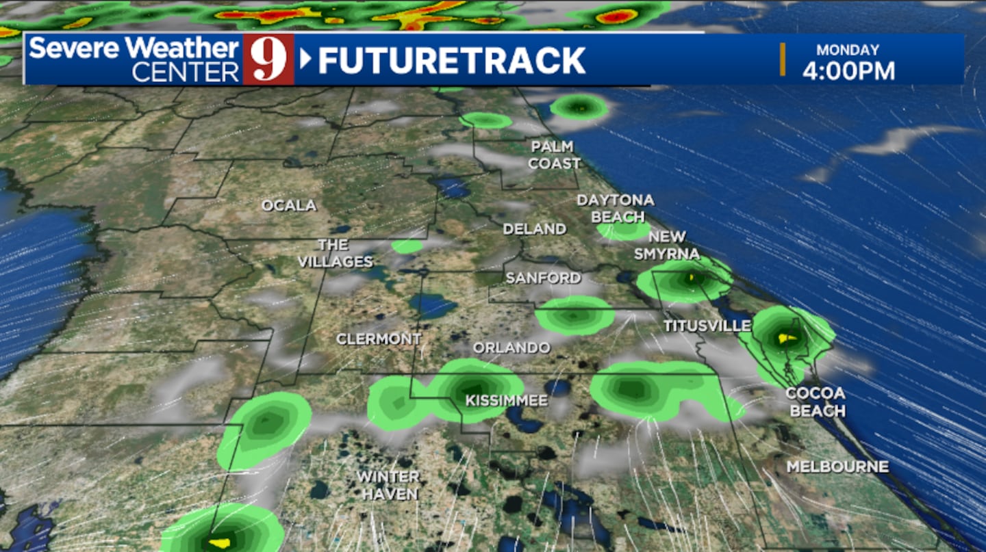
It seems the Saharan dust will be slow to clear out Monday. Expect similar rain and storm coverage to Sunday, with many areas remaining dry.
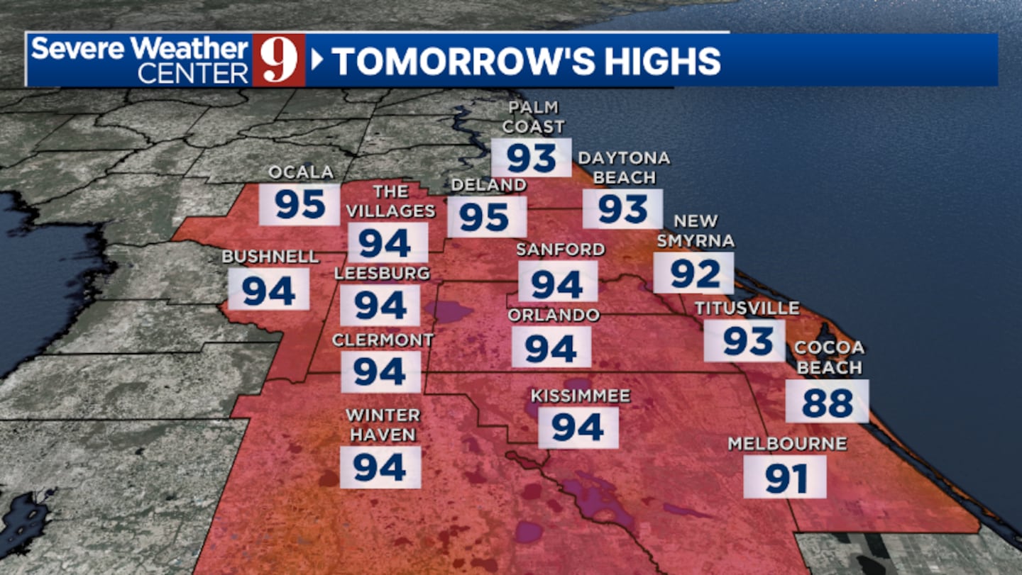
Highs for Monday will be in the mid-90s.
Moisture quickly rushes in by Tuesday, resulting in much higher chances of rain and storms. Activity will mainly be confined to the afternoon and evening hours, with temperatures on Tuesday in the low 90s.
Even more moisture is likely for midweek, with elevated coverage of rain and storms expected.
Temperatures are expected to reach the low 90s on Wednesday and Thursday.
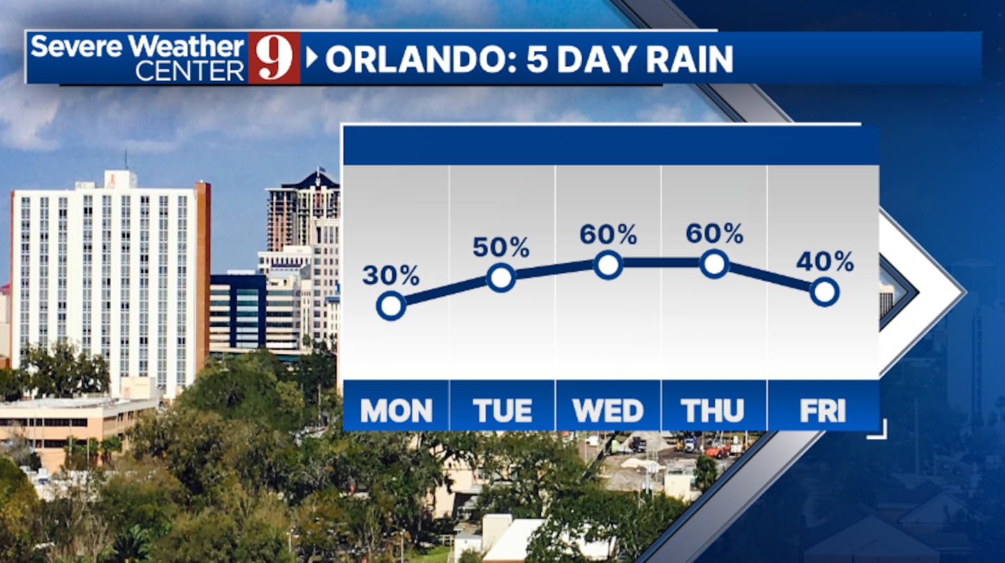
Drier air starts to arrive on Friday, resulting in fewer afternoon storms. Highs to close out the work week will be in the low 90s.
There’s some uncertainty about the rain chances for next weekend, since another round of Saharan dust could move into the area.
Click here to download our free news, weather and smart TV apps. And click here to stream Channel 9 Eyewitness News live.

©2025 Cox Media Group


