
ORLANDO, Fla. — It was a much warmer end to the weekend and the work week will start with higher chances of rain and storms.
A few showers and an isolated storm remain possible this evening, but most will stay dry.
Expect variable clouds overnight, with morning lows in the low 70s.
Moisture is expected to move back into the area on Monday, increasing the chances of rain and storms in the afternoon and evening.
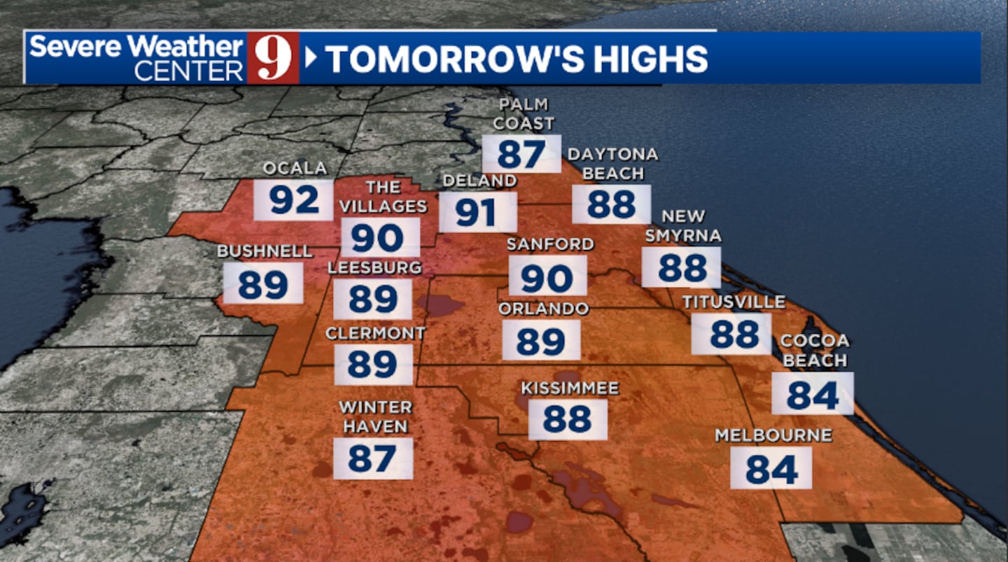
The best chance for activity will be south of Orlando, with highs in the upper 80s.
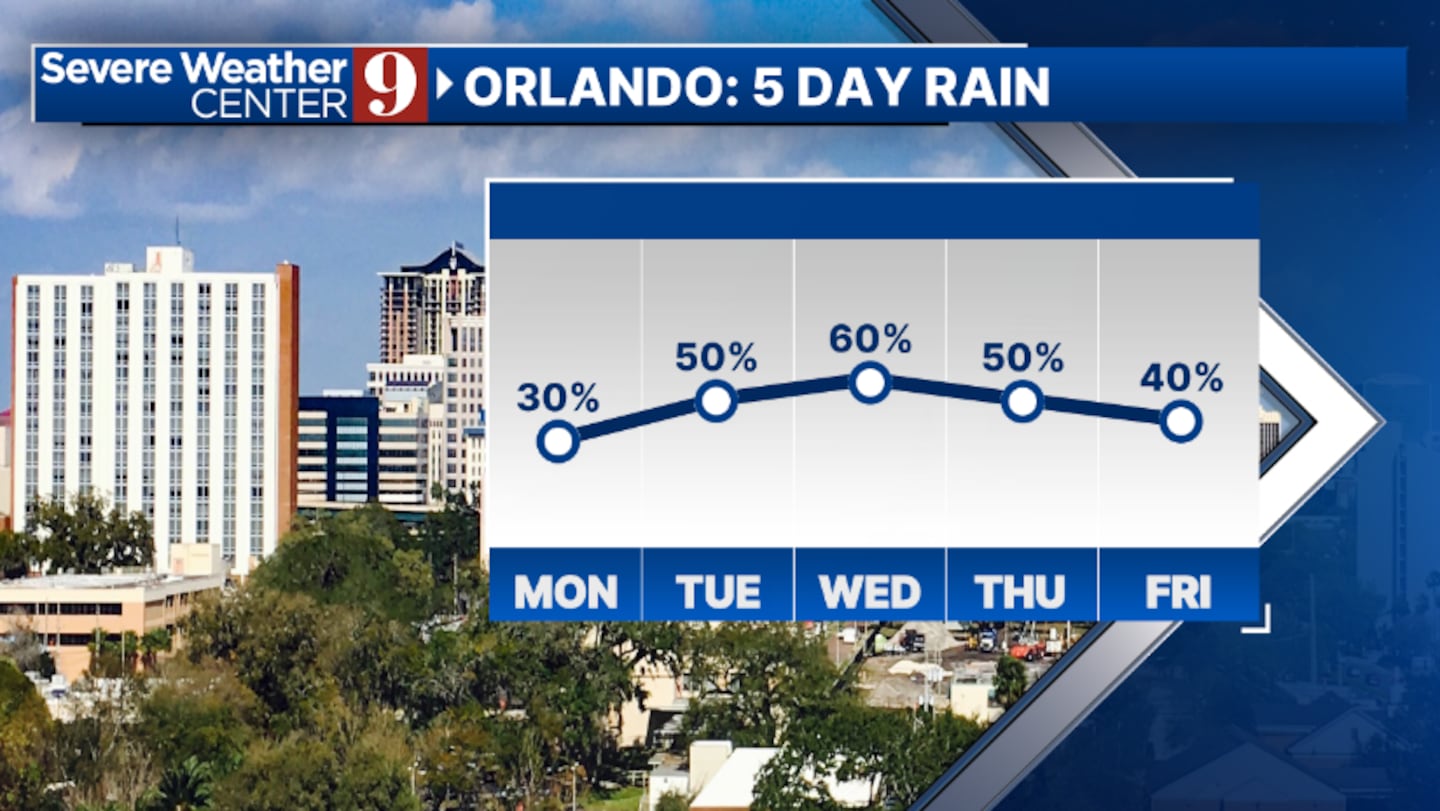
Even more moisture rushes in for midweek. Tuesday and Wednesday will feature elevated rain and storm chances, primarily in the afternoon and evening hours.
Highs both days will be in the upper 80s.
The active weather pattern will likely continue through the end of the work week. Expect decent coverage or rain and storms on Thursday and Friday, with temperatures in the upper 80s and low 90s.
Scattered showers and storms will also be possible for next weekend.
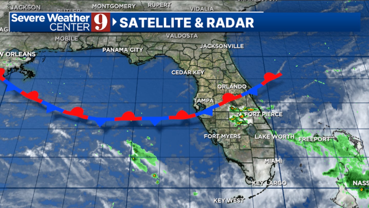
Sunday started the 2025 Atlantic hurricane season.
No significant activity is expected to start the season and quiet conditions are expected for the next seven days.
Click here to download our free news, weather and smart TV apps. And click here to stream Channel 9 Eyewitness News live.

©2025 Cox Media Group


