
, Fla. — Hurricane Erin weakened slightly Saturday night but is still a formidable Category 4 storm north of Puerto Rico.
The 11 pm advisory from the National Hurricane Center now has Erin with winds of 140 mph, making it a Category 4 major hurricane.
Earlier Saturday, Erin was a Category 5 system – making it the strongest hurricane in the Atlantic since Milton last October.
A Tropical Storm Watch continues for the Turks and Caicos, where tropical storm conditions are possible Sunday.
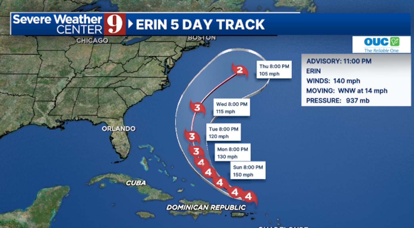
Some fluctuations in intensity are expected through late Sunday, and Erin may have peaked as a Category 5 storm.
The storm has begun to turn to the west-northwest and a turn to the north is expected early next week.
Erin is likely to move just north of the the Virgin Islands and Puerto Rico Sunday.
Long-term, Erin will likely pass between the east coast of the United States and Bermuda next week.
Because of its now expected large size, it is possible Bermuda could get grazed by the storm.
Erin is still expected to stay well east of Florida as it makes a northward turn.
The east coast of the state will likely deal with large swells of 6 to 9 feet and dangerous rip currents early next week from the system.
Dry air will also likely push into Florida, reducing storm chances for the middle of next week.
Stay with Severe Weather Center 9 for the latest on Erin.
Click here to download our free news, weather and smart TV apps. And click here to stream Channel 9 Eyewitness News live.

©2025 Cox Media Group


