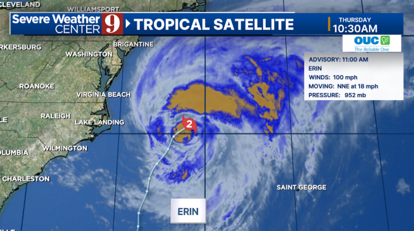
ORLANDO, Fla. — Hurricane Erin is beginning to pull away from the Outer Banks of North Carolina, while three more areas are being monitored in the tropics.
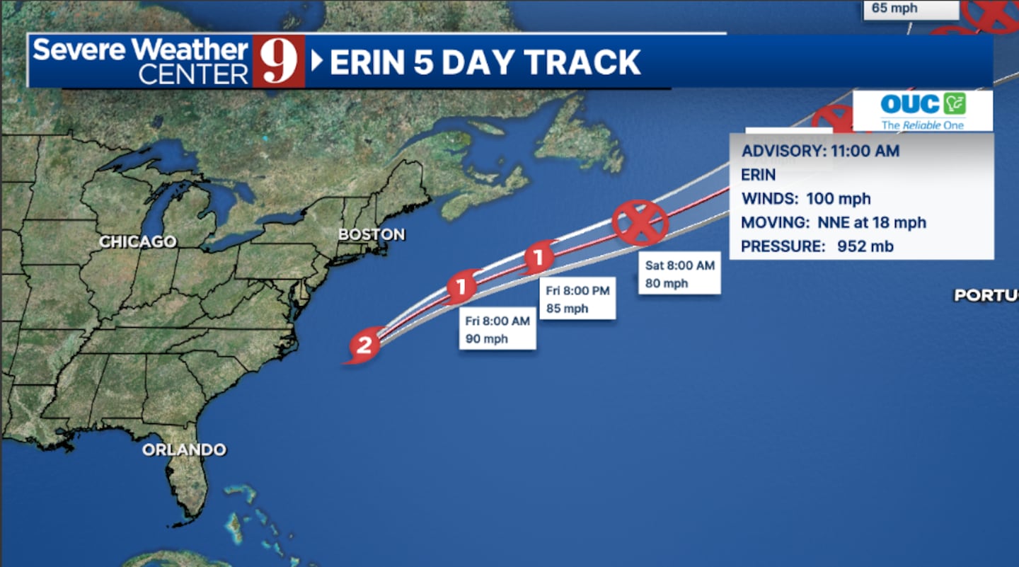
Thursday’s 11 a.m. advisory from the National Hurricane Center has Erin with winds of 100 mph, making it a Category 2 hurricane.
Tropical storm warnings continue for parts of the Outer Banks for North Carolina, where coastal flooding continues.
Erin is also impacting Florida beaches, with large swells and elevated rip current threats continuing.
The hurricane will continue to move away from the US today and slowly weaken late week. It is expected to be post-tropical by Saturday.
Elsewhere, there are three other areas the National Hurricane Center is monitoring for potential development.
The first one is south of Erin and has a High Development Chance.
This will likely become a tropical depression or storm this weekend, but is expected to turn northward away from the US.
A second area in the open Atlantic has a Medium Development Chance and could organize further.
It is possible this system will fade away before making it to the Lesser Antilles.
A third area in the north Atlantic has a Low Development Chance.
Stay with Severe Weather Center 9 for the latest on the tropics.
Click here to download our free news, weather and smart TV apps. And click here to stream Channel 9 Eyewitness News live.

©2025 Cox Media Group


