
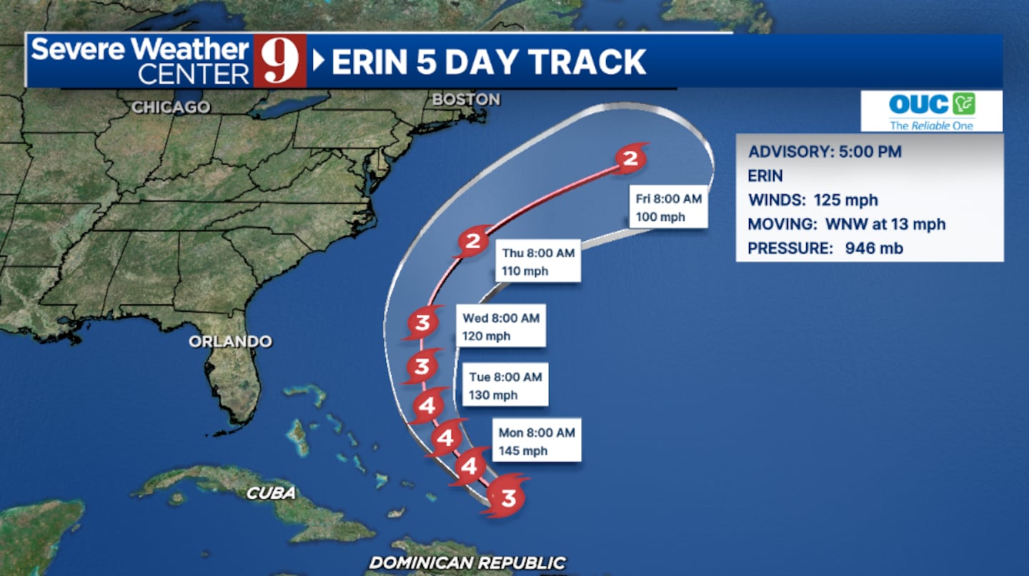
ORLANDO, Fla. — Hurricane Erin remains a Category 3 major hurricane and is forecast to strengthen again as it turns toward the open Atlantic.
The 5 p.m. advisory from the National Hurricane Center listed Erin as a Category 3 major hurricane with winds of 125 mph.
Tropical Storm Warnings remain in effect for the Turks and Caicos, as well as the southeastern Bahamas.
Erin is expected to grow in size and strengthen through Monday night and will probably stay a major hurricane through midweek.
The storm will gradually shift to the northwest and eventually move north on Monday and Tuesday.
Erin is likely to move to the east of the Turks and Caicos and the Bahamas tonight and Monday.
In the long term, the forecast remains consistent that Erin will continue moving north and stay between the Outer Banks of North Carolina and Bermuda.
Due to its now anticipated large size, Bermuda and coastal North Carolina could be directly impacted by the outer edges of the hurricane.
Locally, the east coast of the state will probably experience large swells and dangerous rip currents from Erin starting Monday.
The worst of the swells will probably arrive Tuesday into Wednesday, with waves reaching 6 to 9 feet. Beach erosion will also be a concern during high-tide cycles.
Dry air is expected to move into Florida, lowering storm chances on Tuesday and Wednesday.
Stay with Severe Weather Center 9 for the latest updates on Erin.
Click here to download our free news, weather and smart TV apps. And click here to stream Channel 9 Eyewitness News live.

©2025 Cox Media Group


