ORLANDO, Fla. — Channel 9 is monitoring two active tropical systems that are set to move past Florida in the coming days.
11:30 a.m. update:
Hurricane Humberto is rapidly intensifying in the open Atlantic, while a second system impacting the Bahamas is increasing.
The second area, called Invest 94L, continues to slowly organize north of Haiti and the Dominican Republic.
This system has a high development chance and will very likely be a tropical depression or storm in the next 48 hours.
If trends continue, a Potential Tropical Cyclone may be declared later Friday to begin advisories on the complex.
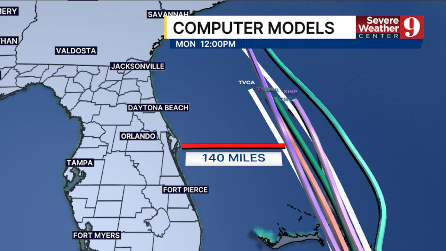
Right now, 94L will likely move across the Bahamas Sunday into early next week and could create marine and beach impacts along the east coast of Florida.
The threat of significant impacts along the Carolina coast continues to increase.
94L is a system that will need to be monitored should it drift further west than currently forecast.
Humberto is rapidly strengthening east of 94L in the open Atlantic.
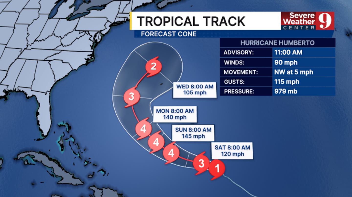
The 11 a.m. advisory on Humberto from the National Hurricane Center has winds of 90 mph, making Humberto a Category 1 storm.
Humberto is forecast to continue rapidly intensifying and is forecast to be a major hurricane later Friday or this weekend.
The storm is moving to the west-northwest and is expected to continue moving west-northwestward the next several days.
Humberto is not a direct threat to land over the next five days.
Gabrielle is pushing toward Europe
Elsewhere in the Atlantic, Gabrielle has become a post-tropical cyclone and is moving away from the Azores.
The latest advisory from the National Hurricane Center had Gabrielle with winds of 65 mph.
Gabrielle will impact parts of Portugal and southern Spain as a post-tropical system this weekend.
Stay with Severe Weather Center 9 for the latest on the tropics.
Original report:
Humberto has strengthened into the third hurricane of the 2025 season, currently classified as a Category 1 storm.
The hurricane is expected to continue gaining strength over the next few days, potentially becoming a major hurricane by the weekend.
Humberto is projected to pass just west of Bermuda next week, staying well off the east coast.
Meanwhile, Invest 94L is currently affecting Haiti and the Dominican Republic, bringing heavy rain and gusty winds to the region.
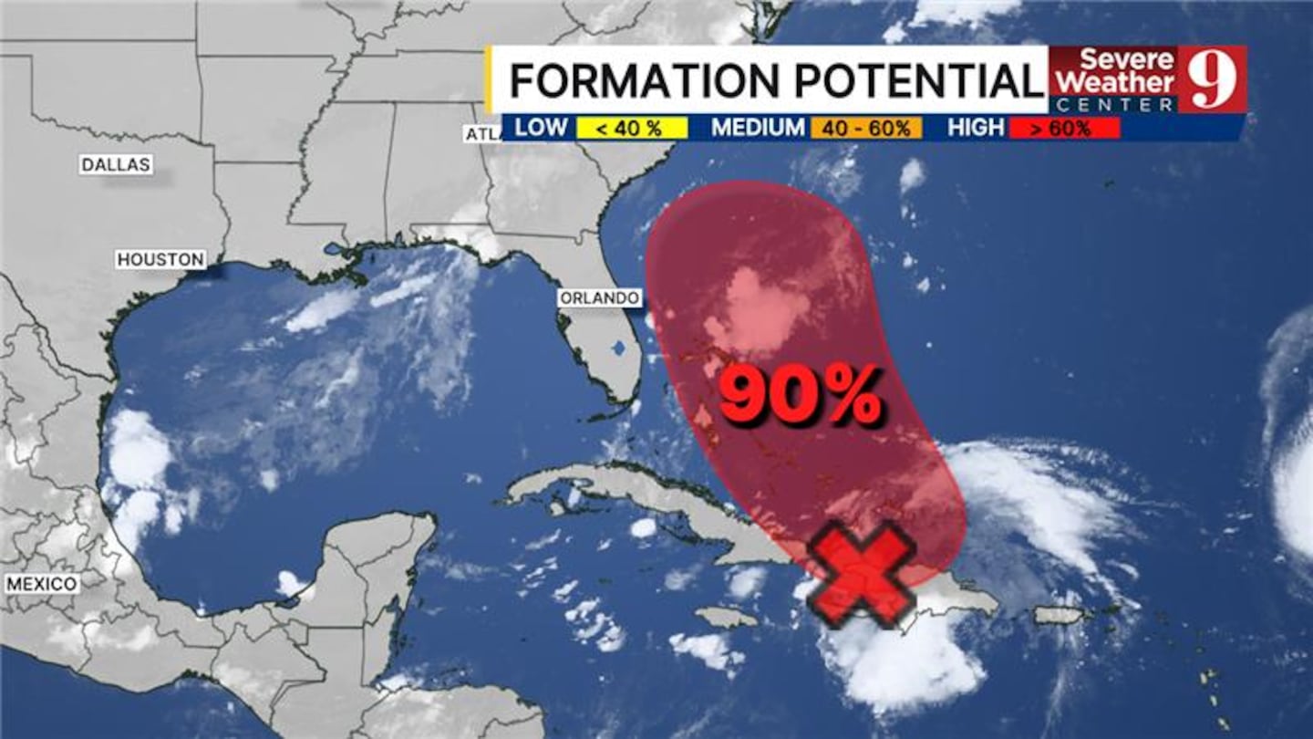
The system is expected to move northward on Friday, which could lead to further development.
There is a possibility that Invest 94L could develop into a Potential Tropical Cyclone (PTC), a tropical depression, or even be named Imelda later Friday.
If this occurs, NOAA will provide a five-day track for the system.
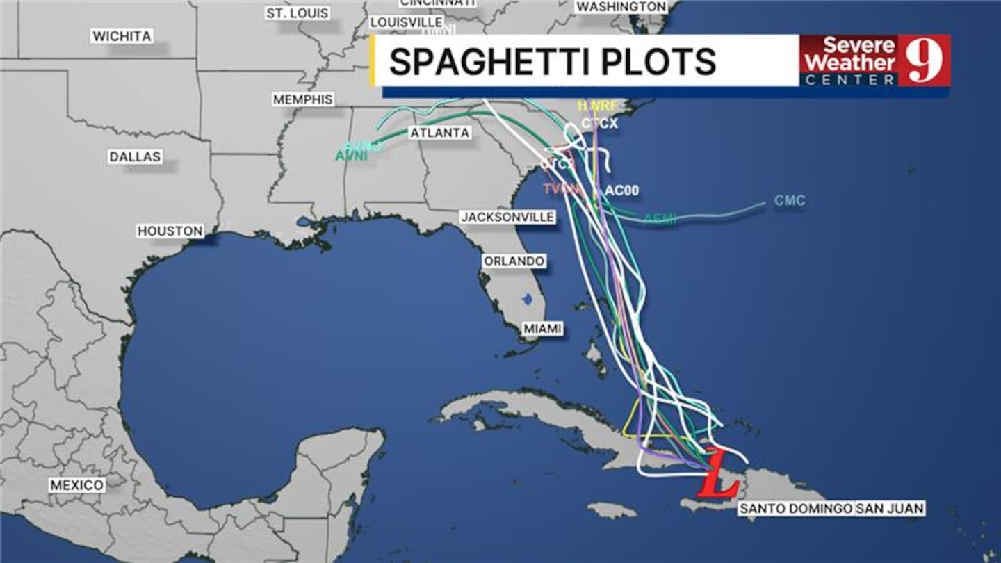
Models suggest that the soon-to-be Imelda could parallel the coastline this weekend and into early next week, with coastal impacts expected starting Sunday.
Dangerous sea and surf conditions are anticipated on Florida’s East Coast.
There are currently no active coastal advisories or warnings for Florida, but the National Weather Service may begin issuing these as early as Friday.
Residents along the coast should stay informed about the progress of both Humberto and Invest 94L, as conditions could change rapidly.
Click here to download our free news, weather and smart TV apps. And click here to stream Channel 9 Eyewitness News live.

©2025 Cox Media Group


