
ORLANDO, Fla. — Scattered showers and storms will wind down this evening, but chances of rain and storms are set to increase over the weekend.
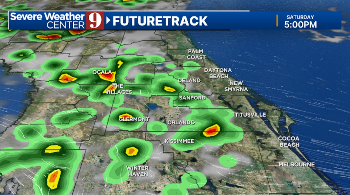
As the weekend approaches, more moisture will push into the area, leading to higher chances of rain and storms, particularly in the afternoon on Saturday. Despite the increased precipitation, temperatures will remain high, with the mercury reaching the mid-90s and heat indices soaring into the triple digits.
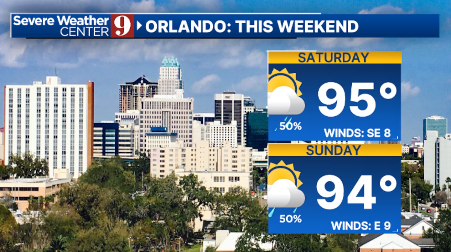
On Sunday, the elevated rain and storm coverage will persist, though temperatures are expected to be slightly cooler, with highs in the low 90s. The pattern of scattered rain and storms will continue into Monday, albeit with reduced coverage compared to the weekend.
Looking ahead to midweek, as Erin moves northward across the Atlantic, it will bring drier air into Florida. This shift is expected to decrease the coverage of rain and storms, while temperatures will remain in the low-to-mid 90s. By the end of next week, higher rain and storm coverage is anticipated again, suggesting a return to wetter conditions.
With fluctuating weather patterns, residents should prepare for a hot and stormy weekend, followed by a brief respite midweek before rain chances increase again.mid-90s
Click here to download our free news, weather and smart TV apps. And click here to stream Channel 9 Eyewitness News live.

©2025 Cox Media Group


