
ORLANDO, Fla. — It was a hot start to the weekend, and our heat wave gets even hotter in the coming days.
In inland areas, a few showers will be possible through mid-evening, but most will stay dry. It will stay warm overnight, with morning lows in the upper 70s.
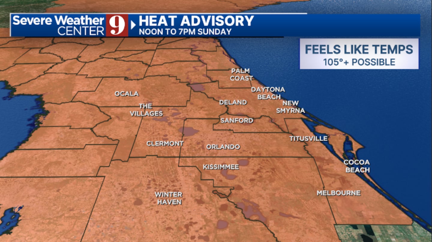
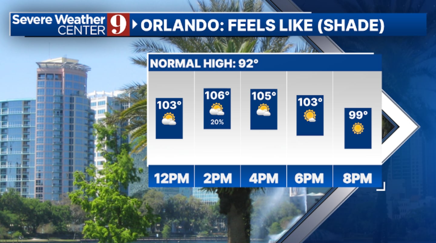
Even hotter temperatures are expected for Sunday. A Heat Advisory is in effect, with heat indices above 105 likely. Highs will push into the mid- and upper 90s, with just a few isolated PM showers.
Our hottest day will likely be on Monday. Highs will push into the upper 90s for much of Metro Orlando and inland areas, with heat indices above 108 possible. A few PM showers will again be possible.
Slightly cooler weather returns for midweek, as moisture and rain chances increase. We’ll see scattered PM storms on Tuesday, with temps still in the mid-to-upper 90s.
Even higher rain and storm chances are likely late week, with highs back down to the mid-90s.
Click here to download our free news, weather and smart TV apps. And click here to stream Channel 9 Eyewitness News live.

©2025 Cox Media Group


